
Tag: Travel
-
Fun with Highways: California Highway 41
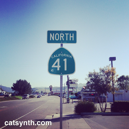
A few years ago, I acquired several highway shields to use in photography, including one for California Highway 41. It was particularly good for photos like that one shown above. But I only knew small bits of the road itself. So when a certain birthday came to pass recently, I decided it was time to travel Highway 41 in its entirety.
Highway 41 begins in Morro Bay at an interchange with Highway 1. Morro Bay is a cute seaside town, and is distinctive for its large volcanic rock along the ocean.


The highway heads northeast through a relatively gentle section of the coast range and crosses US 101 in the town of Atascadero. It then climbs into the hills as a narrow two lane highway. Along the way it passes the many bucolic scenes of farms and ranches. As it climbs the hills, the trees disappear but the landscape remains quite green.

A little further north, Highway 41 joins Highway 46, a major east-west connector, and runs concurrently for a while. The change in traffic and speed was unmistakable.

As one heads east, the land becomes a drier and more sparse. 41 splits from 46 and heads north on its own. After coming over a ridge, the highway descends into a rather arid valley, quite different from the coast and the verdant hills further south.

We cross Highway 33 at a rather unassuming junction. There was an interesting looking roadhouse there, and I wish I had the courage to stop and try it. But I did press on across another, even more arid ridge to a junction with I-5 near Kettleman City. Kettleman City, which is not really a city or even an incorporated town, is probably the single sketchiest location along the entire route. I had been here before and taken a few photos. One of my favorite sites is still “alive and well.”

Continuing north, we move to the interior of the Central Valley at the edge of the former Lake Tulare, once the second largest freshwater lake entirely within the United States. It has since completely dried up, leaving a very flat landscape of farms. Many fields appeared to be fallow, perhaps due to the drought. It is a beautifully bleak landscape.

Just west of the town of Hanford, Highway 41 crosses CA 198, another major east-west highway. 198 is a freeway here, something I was not aware of. 41 itself becomes a four-lane expressway north of the interchange, and increasingly busy as we head north towards Fresno. As we pass the city boundary, it becomes a full freeway. It traverses the area south of downtown as an elevated viaduct, where it crosses Highway 99 and provides access to both downtown and nearby industrial neighborhoods.

I stopped here to do some photographs, one of which already appeared in an earlier Wordless Wednesday. Here are some more.


Heading north out of Fresno, 41 becomes the Yosemite Freeway, as it heads north towards the park.

The freeway narrows and then becomes a surface road as it approaches the foothills of the Sierra. The road climbs steeply into the hills and then descends equally steeply into the town of Oakhurst. The road narrows and climbs again into more mountainous wooded terrain.

We find the signed END of Highway 41 as we approach the southern border of Yosemite National Park.

But this is not the end the real end. The legal definition of Highway 41 continues into the park, although it is not signed as such. It goes through a tunnel the exit of which provides spectacular views of the Yosemite Valley.

Ultimately Highway 41 ends at a junction with (also unsigned) Highway 140 as it enters the valley.
This was an interesting road to complete beyond its numerical value in that it crossed through so many terrains and parts of the state. And a worthwhile and unique trip.

-
MoMA: Rene Magritte, Isa Genzken, John Cage, Dorothea Rockburne
There is always a lot to see at the Museum of Modern Art (MoMA) whenever I return to New York. This includes major exhibitions as well as smaller surprises tucked away in the labyrinth of galleries on the lower floors.
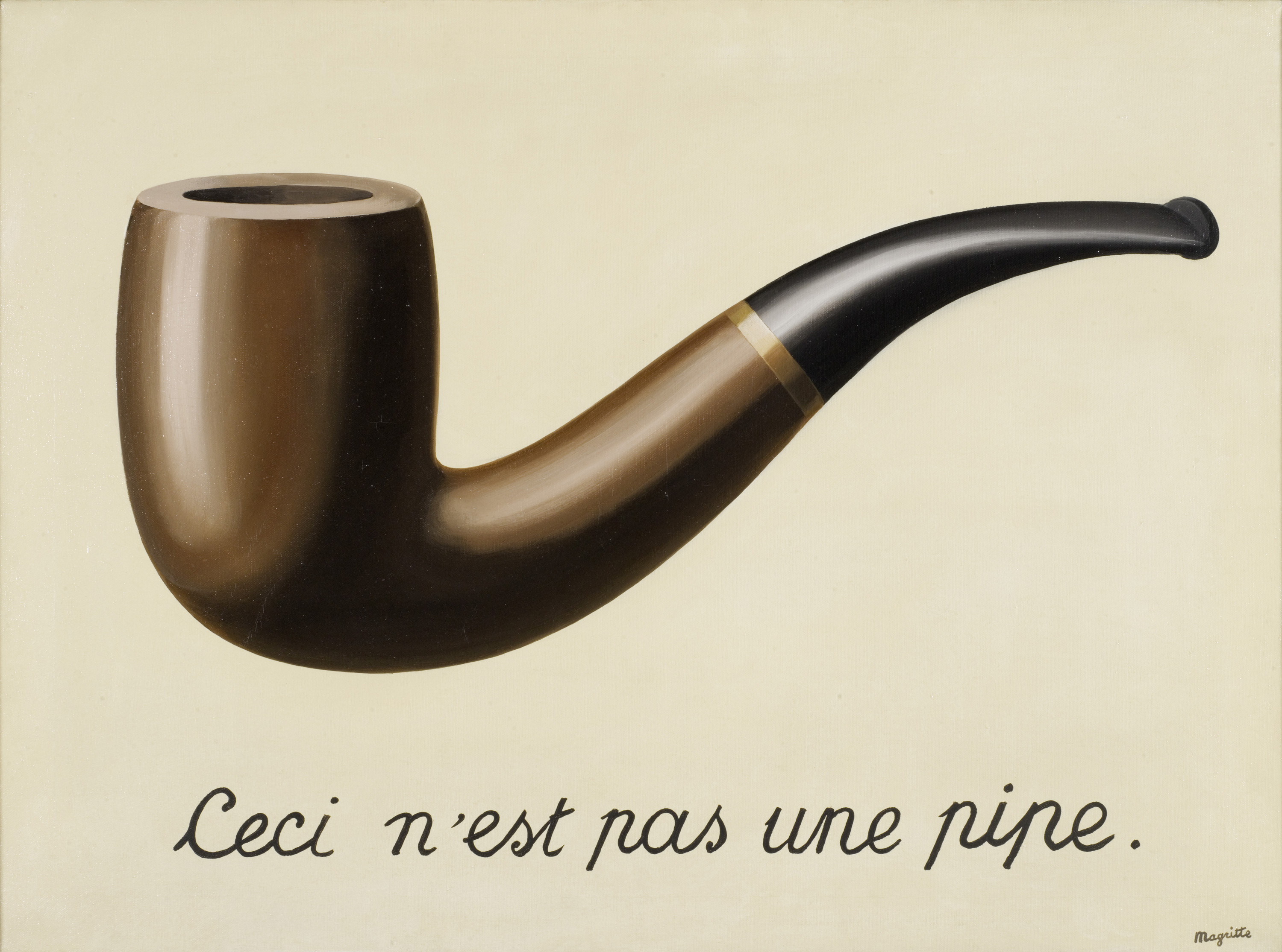
Of course, the most featured (and crowded) show was Magritte: The Mystery of the Ordinary, 1926–1938. The exhibition is not a retrospective, but rather concentrated on a period of about ten years during which Rene Magritte developed his surrealist language and techniques. There are the deceptively simple scenes of everyday objects with unexpected or even disturbing details, as well as the early conceptual works that demonstrated his thinking about art, including This Is Not a Pipe.

[René Magritte (Belgium, 1898-1967). La trahison des images (Ceci n’est pas une pipe) (The Treachery of Images [This is Not a Pipe]). 1929. Oil on canvas. 23 3/4 x 31 15/16 x 1 in. (60.33 x 81.12 x 2.54 cm). Los Angeles County Museum of Art, Los Angeles, California, U.S.A. © Charly Herscovici -– ADAGP – ARS, 2013. Photograph: Digital Image © 2013 Museum Associates/LACMA,Licensed by Art Resource, NY]
[René Magritte (Belgium, 1898-1967). Le portrait (The Portrait). 1935. Oil on canvas. 28 7/8 x 19 7/8″ (73.3 x 50.2 cm). Museum of Modern Art. Gift of Kay Sage Tanguy. © Charly Herscovici -– ADAGP – ARS, 2013]While the exhibition doesn’t include some of his works with which I was most familiar (such as Les valeurs personelles), it was an opportunity to see early pieces I had never seen before. One can see in all of these the focus on out-of-cotext objects and repeated motifs such as bowler hats. The use of text and images disconnected from conventional meaning appears through many of the pieces as well. In addition to the paintings, which dominated the exhibition, were also collages and 3D objects from pre-existing elements, popular forms among Magritte’s contemporaries.
Located across the hall from Magritte, Isa Genzken’s large retrospective exhibition was quite a contrast in terms of its scope and style. Rather than focused on a period of the artist’s career, it covered almost four decades from the 1970s to the present, during which Genzken’s practice changed significantly. Her earliest pieces indirectly incorporated elements of sound, with sculptures representing waveforms linearly or in polar projection (e.g., “ellipsoids”), and photographs of 1970s stereo system advertisements. From there, she moved to themes representing modernism and urban landscape, including in a series of large works made of concrete or other building materials, displayed together in a large room. While the largest suggested modern architecture, some of the concrete pieces suggested urban ruins.

[Installation view of the exhibition Isa Genzken: Retrospective. November 23, 2013–March 10, 2014. © 2013 The Museum of Modern Art, New York. Photograph: Jonathan Muzikar]From the very minimal and geometric, Genzken’s work seems to have taken a turn for the more playful, with a large variety of colorful mixed-media pieces. She also poked fun at artistic conventions with her Fuck the Bauhaus series of assemblages.

[Isa Genzken. Fuck the Bauhaus #4, 2000. Plywood, Plexiglas, plastic slinky, clipboards, aluminum light shade, flower petals, tape, printed paper, shells, and model tree. 88 3/16 x 30 5/16 x 24″ (224 x 77 x 61 cm). Private Collection, Turin. Courtesy AC Project Room, New York. © Isa Genzken]There is a more serious tone, and one simultaneously hopeful and melancholy in her pieces made in response to the September 11, 2001 attacks in New York. The event affected her deeply, as it did many of us, and I found myself lingering with these last pieces to find the emotion along with the lines, shapes and colors.
It seems like every visit to MoMA includes some show that directly or indirectly includes John Cage. This time, there was a small exhibition There Will Never Be Silence: Scoring John Cage’s 4’33″ built around the museum’s original score of the piece (in proportional notation). Works from the disparate schools such as Fluxus and minimalism and spanning a wide range of artists including Robert Rauchenberg, Josef Albers, Yoko Ono and Dick Higgens are included, and each some way explores the concepts of silence and space exemplified by 4’33”.


[John Cage. 4′33″ (In Proportional Notation). 1952/1953. Ink on paper, each page: 11 x 8 1/2″ (27.9 x 21.6 cm). The Museum of Modern Art, New York. Acquired through the generosity of Henry Kravis in honor of Marie-Josée Kravis, 2012. © 2013 John Cage Trust]
[ Dick Higgins. Graphis No. 19 (Act One of Saint Joan at Beaurevoir). 1959. Felt-tip pen, ink, and pencil on paper, 14 x 16 7/8″ (35.6 x 42.8 cm). The Museum of Modern Art, New York. The Gilbert and Lila Silverman Fluxus Collection Gift, 2008. © 2013 Dick Higgins]The minimal and conceptual is also at the heart of Dorothea Rockburne: Drawing Which Makes Itself. The exhibition, which has the same name as one of the artist’s early exhibitions in 1973, focuses on the use of carbon paper and basic drawing processes to realize large-scale works on paper and on the walls and floor. Some, like Triangle, Rectangle, Small Square were self contained and made the simple shapes and curves life-size, while pieces covering entire walls and floors gave the concept of drawing a larger-than-life but nonetheless inviting quality.

[Dorothea Rockburne. Triangle, Rectangle, Small Square. 1978. Colored pencil on transparentized paper on board. 33 x 43″ (83.8 x 109.2 cm). The Museum of Modern Art, New York. Gift of Sally and Wynn Kramarsky. © 2013 Dorothea Rockburne / Artists Rights Society (ARS), New York]There was much more to be seen at MoMA, some of which like the recent photography acquisitions can be difficult to summarize in an article like this. Like many of the places I visit in New York, I really should be going more than once a year.


