

Author: catsynth

  • Wordless Wednesday: Household Gods (Open Studios Preview)

    Wordless Wednesday: Household Gods (Open Studios Preview)

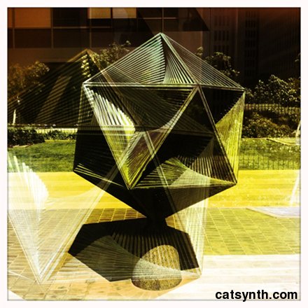
    This is one of many new pieces I am presenting at Art Explosion Spring Open Studios in San Francisco this weekend. It’s the most stylized and provocative piece to date.

  • Fun with Highways: Illinois

    Fun with Highways: Illinois

    Our primary highways series continues today with a visit to the state of Illinois.

    Throughout this series, I have been drawn to many of the large cities of the Midwest and Great Lakes. And none of these looms larger than Chicago. And none is taller. Chicago is home to the tallest building in the United States, the Sears Tower (officially, it is now called the Willis Tower but I doubt too many people call it that).

    Downtown Chicago is a true vertical city, with not just a few tall buildings, but the densely packed skyscrapers that form deep canyons, much like Manhattan. But the presence of the Chicago River cutting a channel through the middle of downtown is quite unique. The buildings seem to come up to the water’s edge.


    [Photo by mdesisto on flickr. (CC BY-NC 2.0)]

    The Chicago River connects to Lake Michigan, but thanks to the miracles of human engineering, it actually flows in the other direction away from the lake (UPDATE: thanks to an astute reader on DailyKos for the correction!). US 41, Lake Shore Drive crosses at the mouth of the river in this unusual double-decker drawbridge. (The Aon Center is the tall building in the background. It reminds me a bit of something else.)

    US 41 / Lake Shore Drive continues north and south of bridge as a scenic expressway with city buildings to one side and beaches along the lake to the other. The south end of the expressway is in the Hyde Park neighborhood, home of a certain Barack Obama.

    Back in downtown, we find the complicated Circle Interchange, where I-90 and I-94 intersect with I-290 and the Congress Parkway. This interchange, which is often considered one of the worst bottlenecks in the country, connects the downtown to the lakefront and to the suburbs south and west of the city.


    [By Stratosphere (Own work) [GFDL or CC-BY-SA-3.0-2.5-2.0-1.0], via Wikimedia Commons]

    If we take I-290 west from this geometric oddity of an interchange, we come to the suburb of Oak Park. It was here that Frank Lloyd Wright began his storied architectural career. His home and studio in the town is a landmark, and there are numerous early examples of his prairie-style houses. Looking at his home and studio, one can see the elements that would be later refined in prairie style.

    There is so much in Chicago I could go on about with regards to art, architecture, music and culture, but space is limited. I do have to give a shout-out to the Art Institute of Chicago, however. It’s collection is large and encyclopedic, but they do have sections that focus on both American and contemporary art. I would particularly like to see the new modern wing, both the building and the art contained within. For music, I invite readers to share the ideas and suggestions of what to explore in the city.

    Back at the Circle Interchange, we head south on I-90/I-94, the Dan Ryan Expressway., one of the widest and busiest highways in the country. It has wide sections for both local and express lines, and a line of Chicago’s “L” runs down the center. I-90 veers off onto the Chicago Skyway, but I-94 continues south (though designated as “east”) on the Dan Ryan Expressway until the junction with I-57.


    [By Zol87 from Chicago, Illinois, USA (http://www.flickr.com/photos/zol87/2721964632/) [CC-BY-SA-2.0], via Wikimedia Commons]

    Continuing south on I-57, we pass by our friend I-80 in the southern suburbs of Chicago and eventually come to Champaign and Urbana after crossing I-74 – it does seem that Illinois has a lot of interstate highways. This cities are home to the University of Illinois at Urbana Champaign, the flagship campus of the University of Illinois. It hosts the NCSA (The National Center for Supercomputing Applications) that created the first graphical web browser Mosaic.


    [By Ragib Hasan (Own work) [CC-BY-SA-2.5], via Wikimedia Commons]

    It’s hard to imagine life without this technology now, it is ubiquitous and integrated into so much of information, communication and entertainment. Of course, without it you would not reading this article, and I would probably not be writing it. Earlier in its history, the University was home to ILLIAC. At the time it was activated in 1952, it was the largest computer built and owned by an American university. This huge vacuum-tube based machine had 5 kilobytes of main memory and 64k of drum memory. For perspective, consider how much more memory and computation is in an iPhone now.

    Before we overdose on computer history, we exit Champaign-Urbana on I-72 heading westward. (Did we mention that Illinois has a lot of interstate highways?). This view along the highway suggests just how flat the landscape is in this region, with the road completely straight.


    [By Dual Freq (Own work) [GFDL, CC-BY-SA-3.0 or CC-BY-2.5], via Wikimedia Commons]

    Continuing on I-72, we come to Springfield, the state capital.


    [Éovart Caçeir at en.wikipedia [CC-BY-SA-3.0 or GFDL], from Wikimedia Commons]

    Springfield is steeped in the history and mythology of Lincoln, probably more than any other city in the state. He lived there for 24 years and launched his political career there. And his final resting place, Lincoln’s Tomb is in Springfield.


    [Lincoln’s Tomb, Oak Ridge Cemetery, Springfield, Illinois, 2006. Robert Lawton (self), via Wikimedia Commons.]

    We also find another well-known Frank Lloyd Wright home in Springfield, the Dana-Thomas House. It has rather large and often considered a “prairie mansion”. It does contain the horizontal forms and low angular ceilings characteristic of prairie style, but the most notable features that distinguish are the windows.

    We head south from Springfield on I-55, on another incredibly straight stretch of highway through very flat landscape. For those who have lived among hills our entire lives, these flat plains are a novel experience. It’s not only the land, but also the sky.


    [Photo by tlindenbaum on flickr. (CC BY-ND 2.0)]

    There is a significant break in the flat landscape of western Illinois along the Illinois River. Illinois Route 100 runs along the the west bank of the river amidst trees and bluffs. It then crosses a bridge and continues along the east side until the Illinois River meets the Mississippi River.

    [Photo by kittell on flickr. (CC BY-NC 2.0)]

    IL-100 continues along the Mississippi as part of the the Great River Road. As one can see, the landscape here is no longer flat.


    [By Kbh3rd (Own work) [CC-BY-SA-3.0], via Wikimedia Commons]

    The Great River Road continues past the end of IL-100 and into the greater St. Louis metropolitan area. As the landscape along the river becomes more suburban and then urban in St. Clair county, the road bounces around many other designations, including I-70 in East St. Louis. From here we can continue across the Mississippi to St. Louis itself, or continue southward on the Great River Road as IL-3.

    We opt for the latter, passing through towns with Egyptian sounding names until we come to Cairo, at the southern tip of the state, where the Ohio and Mississippi rivers meet. We meet I-57 again and then continue into the town itself on US 51. Cairo (pronounced KAY-RO) was once a significant center of trade along the rivers. But it has been in a long decline, and now has a population of about 2,800. Indeed, some views of the town make it look nearly abandoned.


    [Photo by gobucks2 on flickr. (CC BY-NC-SA 2.0)]

    The photo almost looks like something from Doug Rickard’s series. It’s sad, but also quite interesting in a way. It’s a long way between Chicago and Cairo, but it would be great to see and photograph both of them in one big trip across the state.

  • CatSynth pic:  Miez and KOMA Elektronik

    CatSynth pic: Miez and KOMA Elektronik

    Submitted by KOMA Elektronik via our Facebook page.

    “Miez together with the KOMA Elektronik pedals!”

  • CatSynth pic: MacBook Taro – cat

    CatSynth pic: MacBook Taro – cat

    Another from Sawa Masaki on flickr.

    I believe the synth in the picture is a Dave Smith Instruments Tetra.

  • Weekend Cat Blogging: The Blue Glass

    Weekend Cat Blogging: The Blue Glass

    This weekend, we are feeling a bit festive. Here are some Hipstamatic photos of Luna with a blue cocktail glass. Perfect for a Manhattan or catnip.

    Luna is curious about the glassware, which fits the overall CatSynth HQ design concept.

    Actually, Luna is a shy cat, and like most cats she is fiercely territorial and prefers to keep an eye on things from the upstairs balcony whenever we have guests.   She often seems relieved when they finally go home.


    Speaking of festive, Weekend Cat Blogging #354: St. Patrick’s Day Edition is hosted by our Texas friends Samantha, Clementine and Maverick.

    The Carnival of the Cats will be up today at Mind of Mog.

    And the Friday Ark is at the modulator.

    For those who may be curious, please check out yesterday’s Puerto Rico edition of Fun with Highways.

  • Fun with Highways: Puerto Rico

    Fun with Highways: Puerto Rico

    This installment in our “Primary Highways” series takes us to the Commonwealth of Puerto Rico. Puerto Rico is not a state, but it is part of the United States. Dealing with that concept is beyond the scope of this article. Instead, we choose to visit like we would any state in the U.S.

    We begin in the capital, San Juan. Specifically, in the old city of San Juan, which was started on a small island just off the main island of the territory. The narrow alleys and colorful buildings are a common feature of colonial cities in the Caribbean, and indeed these images remind me a bit of Havana.

    The narrow streets and buildings seem ideal for walking around and observing architectural details. And with the small size of district, the bay and ocean are part of its visuals. Just to the north of the old city, facing the ocean, is Fort San Felipe del Morro.

    [By Mtmdfan at en.wikipedia (Own work) [Public domain], via Wikimedia Commons]

    At the eastern edge of Old San Juan, two of the streets merge for the start of PR 25, the Avenida Juan Ponce de Leon, which continues east past the Capitol building of Puerto Rico. PR 25 and PR 1 leave the island of San Juan via a pair of causeways to the main island, where PR 1 becomes a major freeway. As it curves around the central city, we observe a very different kind of architecture. The modernist curving Puerto Rico Convention Center has won numerous awards.


    [Photo by chente922 on flickr. (CC BY-NC-ND 2.0)]

    We exit the city east on PR 26, which becomes PR 66 in the city of Carolina. And after the freeway ends we continue on PR 3. Eventually we turn south onto PR 191, which is the goal of this side trip from San Juan. This small highway winds its way upward into the El Yunque Rainforest. It is the only true tropical rainforest in the U.S. National Forest System


    [By AjaxSmack (Own work) [CC-BY-SA-3.0 or GFDL], via Wikimedia Commons]

    While I have been more drawn to the desert over the years, the textures, lush colors and imagined warm humid climate pique my interest. El Yunque has unusual vegetation even for a tropical forest (including the unique “dwarf forest”), waterfalls, and the ever popular frogs known as the coquí.


    [By United States Department of Agriculture (en.wiki) [Public domain], via Wikimedia Commons]


    [Photo by Jmoliver. (CC BY-SA 3.0)]

    One the sides of one of the peaks is Yokahu Tower.


    [Photo by Joe Shlabotnik on flickr. (CC BY-NC-SA 2.0)]

    The shape gives it an appearance of an old castle (or perhaps a chess piece), and cracked paint set against the tropical vegetation adds an air curiosity. But it’s main function is as an observation tower, providing spectacular views of the hills and forest.

    Returning to San Juan, we can head west on PR 2 along the coast to Arecibo, home of the Arecibo Observatory.

    The observatory conducts radio astronomy and has attracted attention for its use int he SETI@Home project for crowd sourcing of potential intelligent signals from space. It has also been involved in many scientific discoveries related to our Solar System, and two exotic astronomical objects like pulsars and neutron stars. It has struggled with funding in recent years (sadly, certain groups target both public funding and all things scientific at the same time), but it is still operating.

    Back in San Juan, we head southward through the center of the island on PR 52. This is a busy toll expressway, but outside the cities it stretches across hilly countryside in the interior of the island. As we approach the southern coast, we can stop at one of Puerto Rico’s few highway rest stops and see both human-made and natural landmarks, the Monumento al Jíbaro Puertorriqueño and Las Tetas De Cayey.


    [By Roca Ruiz (http://www.flickr.com/photos/roca-ruiz/5358901411/) [CC-BY-SA-2.0], via Wikimedia Commons]

    PR 52 ends in the city of Ponce on the southern coast. The city is known on the island as a major center for the arts, and ishome to many museums including Museo de Arte de Ponce.


    [By Oquendo on Flickr (appears to be Jose Oquendo here.) (Flickr.) [CC-BY-2.0], via Wikimedia Commons]

    The building itself is a work of art, built in the 1960s and designed by architect Edward Durell Stone. Their primary collection is traditional European Art – something that sounds at first description a bit jarring for the building. But their signature piece is more modern, the 25-foot Pinceladas al vuelo (Brushstrokes in Flight) by Roy Lichtenstein.

    With on in mind, we continue west from Ponce on PR 2 – this is the same PR 2 we encountered in San Juan, as it traces the coast on the western half of the island – and stop at the ruins of the CORCO refinery.


    [Photo by cavenaghi9 on Flickr. (CC BY-SA 2.0)]

    Like so many other places in this series, this seems like a great place to do some photography work. The pipes and columns are rusting and peeling, but they still stand there. I don’t know whether it is quiet – there is still some industrial activity in the area – but it is what I imagine.

    It’s a no-brainer that a tropical island like Puerto Rico would have beaches. But the southwest corner of the island apparently has some of the most scenic and less populated beaches – which is what I would prefer if I was there. We exit PR 2 onto PR 116 past the town of Guánica, where we come to Las Paldas and La Jungla beaches. We conclude with this video of quiet beaches on Guánica Bay.

  • CatSynth video:KOMA Elektronik goes guerrilla at Musikmesse 2012

    We at CatSynth can’t be at Muskmesse this year, so we are living vicariously through our friends at KOMA Elektronik.

    ore information: http://www.koma-elektronik.com/musikmesse
    Facebook: http://www.facebook.com/KOMAelektronik

    As a small Berlin based analog effects manufacturer we have no large promotion budget, this is why this year KOMA Elektronik will go guerrilla at Musikmesse 2012. Instead of the “usual” booth the KOMA crew will be driving the press and everybody else who is interested in our products around in the “KOMA Cab,” and we’ll throw a big party on thursday night. You wanna fight the good fight with us?

    PLAYING AT OUR PARTY (MARCH 22ND):

    EMIL NIKOLAISEN & ÅDNE MEISFJORD (Serena-Maneesh, NO) (4AD)
    http://4ad.com/artists/serenamaneesh

    KAAP DE GOEDE HOOP (Planty Herbs, NL) (WAX-ON Records)

    O TANNENBAUM DJ’S (Ole Records, Berlin)
    http://o-tannenbaum-berlin.de/

  • CatSynth pic:  Video on the Wurlitzer Electric Piano

    CatSynth pic: Video on the Wurlitzer Electric Piano

    Another picture of Video the cat relaxing on the Wurlitzer 200e electric piano. Submitted by The Wiggly Tendrils via our Facebook page.

  • Wordless Wednesday: Toy Building (Oakland)

    Wordless Wednesday: Toy Building (Oakland)

    For those who enjoy the Hipstamatic photos, please check out my review of the #iSnapSF show. And while you’re at it, there is also yesterday’s Fun with Highways installment.

  • Fun with Highways: Mississippi and Alabama

    Fun with Highways: Mississippi and Alabama

    In this installment of our “primary highways” series, we look at the states of Mississippi and Alabama. In some ways, this is a particularly challenging edition, as I have never personally visited either of the states – in fact they are among only five remaining states I have yet to visit (Kansas, which held its causes on Saturday, is another of the five).  So we will do the best we can.

    I did come close to visiting Mississippi in 2006. For one day while I was in New Orleans, I had rented a car to reach places outside the public transportation grid that was still limited after Hurricane Katrina, including the Lower Ninth Ward. I was tempted to get back on I-10 and head east to Mississippi, just to be able to say I was there. But in the end I decided against it. Had I continued, I would have crossed into Mississippi in a sparsely populated area along the Pearl River. To the north of I-10 is the John C Stennis Space Center, where NASA has tested engines for many of our legendary space vehicles including the Apollo Saturn V and the Space Shuttle.

    Given that it is an engine test facility, it’s not surprising there isn’t much of a permanent population in the area. Several communities were removed when it was built, and supposedly a few remnants of the communities, particularly Gaineville, still exist. Indeed, off of Highway 607, the “Shuttle Parkway”, is Lower Gainesville Road, which heads past various space-center complexes towards the Pearl River and ends at what could be the remains of the town.

    Heading southward on 607 from I-10, we eventually reach US 90, which continues along the Mississippi coast through the towns of Waveland and Bay St Louis, which were devastated by Hurricane Katrina. Perhaps the most dramatic example was the bridge carrying US 90 over St. Louis Bay, which was completely destroyed.

    It has since been replaced by a new bridge, a graceful flowing structure that has won the American Transportation Award and became a symbol for the region.


    [By Frank Kovalchek from Anchorage, Alaska, USA [CC-BY-2.0], via Wikimedia Commons]

    US 90 continues along the coast as Beach Boulevard towards the cities of Gulfport and Biloxi. Biloxi is a big resort and casino town on the coast, but it, too, was devastated by Hurricane Katrina. Although it sounds like there is still much rebuilding to be done, many of the city’s casinos have since reopened and landmarks restored including the iconic Biloxi Lighthouse and the Ohr-O’Keefe Museum Of Art that was designed by Frank Gehry. The Ohr-O’Keefe was under construction when Katrina hit and was severely damaged. It ultimately opened in 2010.


    [By Woodlot (Own work) [CC-BY-SA-3.0 or GFDL], via Wikimedia Commons[]

    South of nearby Gulfport is Cat Island. I thought maybe it had something in common with the famous Cat Island off the coast of Japan, but no such luck. As far as I can tell, there are no cats there, and the name itself was a mistake.

    From the southeast corner of the state, we jump to the northwest corner. Specifically, we are going to a junction outside of Clarksdale where US 61 and US 49 meet. This crossroads is considered by many “the crossroads”, where according to legend blues musician Robert Johnson sold his soul to the Devil in exchange for his musical gifts.


    [By Joe Mazzola [CC-BY-SA-2.0], via Wikimedia Commons[]

    Legend or not, Clarksdale has a particular association with the blues, and is home to the Delta Blues Museum.

    US 49 has long been a major highway traversing the state diagonally. From Clarksdale, it winds its way through the Mississippi Delta, even splitting into separate east and west parts, before leaving the delta and approaching the capital and largest city, Jackson. On the northwest approach to the capital, US 49 carries the name Medgar Evers Boulevard in honor of the civil rights leader who was assassinated in Jackson in 1963. The highway then bypasses the downtown with I-220 and I-20 before continuing to Hattiesburg, home of Southern Mississippi University.

    In Hattiesburg we meet I-59. The drive along I-59 and US 11 to the town of Laurel was recommended to me (actually, the drive south from Laurel to Mississippi State University). In Laurel, I-59 had an unusual S-curve that rivaled Dead Man’s curve in Cleveland due to railroad overpasses, but it has supposedly been reconstructed. I-59 continues north to Meridian, where it joins with I-20.

    Briefly leaving the freeway in Meridian, one can take Highway 19 north to the town of Philadelphia, made infamous for the death of three civil rights workers James Chaney, Andrew Goodman and Michael Schwerner. The murders took place off of Highway 19, and it was presumably the route they took to Neshoba County.


    I-59 and I-20 continue as a single route into Alabama, all the way to Birmingham. It is largest city in either of the states in this article, and is crisscrossed by several major highways. A large interchange between I-59/I-20 and I-65 just west of downtown is known as Malfunction Junction because of the frequent (and unfortunately, sometimes deadly) accidents that happen there.


    [Click to enlarge.]

    Interestingly, it does not look that complex from a map view, especially when compared to a nearby junction of I-59/I-20 and US 31/US 280. While it does look more complex, it does afford a good view of the city skyline when approaching from the south.

    Birmingham has a strong industrial past, especially in iron and steel. Indeed, the Sloss Furnace in the city is one of the few industrial sites preserved as a National Historic Landmark.


    [Timjarrett at the English language Wikipedia [GFDL], from Wikimedia Commons]

    Visitors can wander and enjoy the site, which features defunct but preserved industrial buildings and machinery. This would be a fantastic place to photograph! I could also see it as a musically inspiring location, for pieces based on metallic resonances. The center does hold concerts, and has a highly regarded program in metal arts. (I wonder if they have arts residencies?)

    As has happened with many other industrial cities that experienced long declines, downtown Birmingham appears to rebounding as a residential and cultural center, with lofts and galleries. There is also the restored Alabama Theatre which functions as a performing arts center while retaining many of its movie-palace features, most notably its original Wurlitzer Organ. (It should be noted this is the second Wurlitzer to be featured in this year’s “primary highways” series.)

    South of Birmingham is the town of Selma, which has a storied place in the Civil Rights Movement. A voting rights movement in the town ultimately grew into the Selma to Montgomery Marches in 1965. The marches took place on US Highway 80 heading east from Selma and crossing the Edmund Pettus Bridge.

    The first march was met by state troopers and the marchers were brutally assaulted. Images “Bloody Sunday” were broadcast nationwide, shocking many and galvanizing support among some for the civil rights movement. Two more marches along the same route were organized. The third march passed the bridge and continued all the way east on Highway 80 to Montgomery. The march then veered north onto the Mobile Highway, parallel to present day I-65, and then along city streets to the state capitol. The entire route is now marked as the Selma to Montgomery National Historic Route.

    From the state capital, one can travel south on I-65 to Mobile and back to the Gulf Coast, where we began. We switch on to I-165 which enters the downtown and becomes Water Street. Heading further south, we come back to I-10, which crosses Mobile Bay on a long causeway. From the causeway, we can look back at the city at sunset.

    [Photo by faungg on flickr. (CC BY-ND 2.0)]