This is the first of several articles on my recent “grand loop” through northern California in August. Starting from the Bay Area, north through the Sacramento Valley to the Cascades (including a side trip to Lassen Volcanic Park), and then west to the Mendocino coast and back south to San Francisco.
 The segment of this trip is along I-80, crossing the Bay Bridge and north through Berkeley into the towns of the “North Bay” that always seemed remote even when I was lived in the area. I-80 crosses over the New Carquinez Bridge into Solano County, ultimate towards Sacramento.
.png) In order to head north without having to get too close to our state's capital or Arnold, one takes the short-cut known as I-505 into the Sacramento Valley. This is a largely agricultural region of fields and orchards, and it is flat. As in “how much more flat could you be? None more flat.” (Apologies to Spinal Tap).
In order to head north without having to get too close to our state's capital or Arnold, one takes the short-cut known as I-505 into the Sacramento Valley. This is a largely agricultural region of fields and orchards, and it is flat. As in “how much more flat could you be? None more flat.” (Apologies to Spinal Tap).
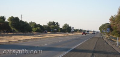
One of the interest sites along the side of the road was this flock of sheep, doing what sheep do best, except for that one looking straight at us:
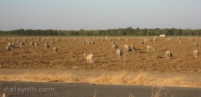
Somehow, sheep are always instant humor. I am not sure why, but it's a fact, they're just funny even when they're not doing anything. We need to confer on them some sort of hip cult status befitting their character. Baaaa!
 I-505 soon rejoins the main I-5 freeway coming north from Sacramento towards the Oregon border. Somehow, I-5 manages to appear even flatter than 505:
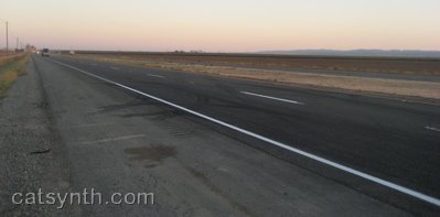
However, such images are a bit deceiving. While the Sacramento Valley is indeed very flat, it is quite visibly bounded by mountain ranges. To the west is the inner Coast Range, and far to the east are the foothills of the Sierra Nevada range. There are also the Sutter Buttes, dubbed the “smallest mountain range in the world.”
Whether we are seeing haze or the infamous Central Valley pollution in this photo isn't clear (no pun intended). The Sutter Buttes are actually quite a distance away from I-5. One surprising characteristic of the Sacramento Valley, at least during this visit, was how humid the air felt, so it could easily just be haze.
Pretty much things continue this way along I-5 until one reaches Redding, the largest city in California north of Sacramento, and the gateway to the Cascades. Very quickly, the highway begins to climb into the foothills, winding its way along the sides of hills and over high valleys (one of which was flooded to create Lake Shasta). No sign of Mt. Shasta. The directions to get there includes those famous words “You can't miss it”, but a first time traveller might begin to doubt that aminst the endless steep green hills and valleys. But then, there it is. And yes, you can't miss it.
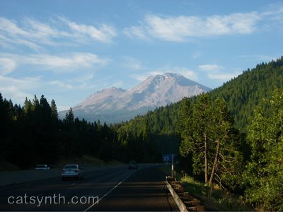
Oh, and here it is again:
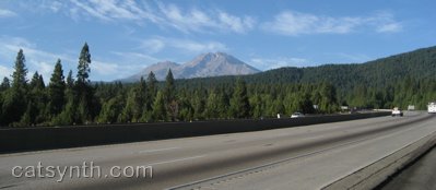
Shasta is a volcanic peak, one of the tallest in the Cascades, and is distinct for being very disconnected from any other other tall peaks. About the closest I could find nearby was this peak which I simply dubbed “pointy mountain:”
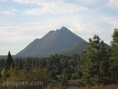
“Pointy Mountain” turns about to be Black Butte, a nearby lava dome (not to be confused with Black Butte in Oregon). It is clearly visible from the town of Mt. Shasta on the other side of I-5 (town on the east, peak on the west).
It is from the town of Mt. Shasta that we take this final shot of the mountain, a little before sunset time:
One thing to note is the lack of snow on the mountain. Granted it is August, but I was here in August 1998 and remember seeing a lot more snow, This is probably a product of our drought in California, including relatively little rain/show this past winter. Whether or not the trend continues, and mountains like Shasta become less “snow-capped”, remains to be seen…


