Fun with Highways: California 99 and 198

The ride back from NAMM is usually an uneventful straight shot up I-5 from Los Angeles towards San Francisco. But I found myself making good time, and in a mood for a bit of exploration – not to mention an opportunity to rack up more routes on my Highway☆ app – so I decided to try something different. I decided to follow California Highway 99 as it splits off from I-5.
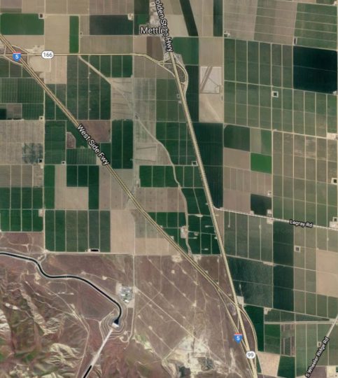
CA 99 takes a more easterly route than I-5 and connects to the major towns and cities of the Central Valley. A stretch in the northern part of the Central Valley was featured in our recent CatSynth TV Episode 99, but the southern part largely remained unexplored outside the immediate vicinity of Bakersfield (where it intersects CA 58). So much of the highway was new.

That southernmost section was, to put it bluntly, rather sad. The road is narrow, bumpy, and crowded. The landscape was dotted with a mixture of fields, run-down housing developments, and strip malls. And the sky was smoggy with an unhealthy yellow hue. But the afterglow of our most successful NAMM show to date along with the spirit of exploration gave a level of joy to the experience. At Visalia, I decided to turn off and head west onto California Highway 198.
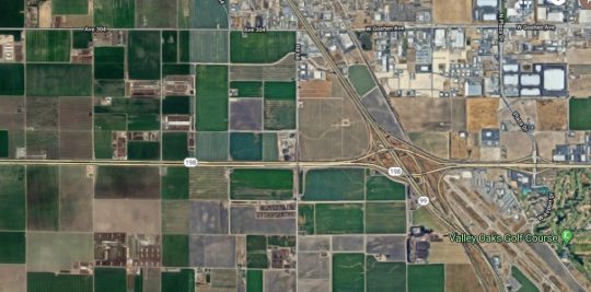
If 99 was a bit of a cluttered and bumpy mess, 198 was the opposite: a pair of smooth straight lines cutting through farmland with sparse development. It began as an expressway but soon turned into a full-on freeway in Kings County as we headed toward Hanford and then on to Lemoore, where we intersected with Highway 41 in a major interchange. A few years ago, I had seen it from the perspective of Highway 41 and mentioned it a post at that time.

There is something strangely fascinating about the island of small towns sitting at the northern edge of dry endorheic Lake Tulare. I can’t quite put my finger on it, but it is strong enough to inspire a story line and possible writing project that I work through in my mind when I have trouble sleeping at night. We will see if anything comes of it.

Past Lemoore Naval Air Station, 198 narrows to a small two-lane route, and becomes significantly less interesting. My mind shifts to the story on the radio about people whose altruism goes to extreme lengths, including a man in India who founded and nurtured a growing community for people with leprosy while putting himself and his family (including two young children) at risk; and a couple who kept adopting more and more children while having less time and attention for their older biological and adopted children. These drives can be seen as incredibly caring and generous, but I also wondered if they were a bit pathological – indeed, the seeming lack of concern for others affected as they pursued their extreme altruism seemed to be mark of a sociopath.

Heading west on the narrow section of CA 198, we approach Interstate 5 again. This is, however, a spot infamous to north-south travelers for its offending aroma. It turns out the infamous small at the Coalinga junction of I-5 and CA 198 comes from the gigantic Harris ranch and feedlot. It only got worse after turning north onto I-5, but soon enough it was behind me and a not-too-long road to San Francisco remained ahead.

See more of California and many other fascinating places in our Highway☆ app, available on the Apple App Store and Google Play Store.

Highway☆ on the Apple App Store
Highway☆ for Android

Fun with Highways: Drive Twenty-Five

So this is a drive I have had on my list for a while. Why, you ask? I don't know really. I guess it's just that it seemed to go nowhere. Actually, it's a country highway that runs approximately along the San Andreas fault in San Benito County, in between mountain ranges. And a quiet fun drive into uncharted territory is exactly what I was looking for.

This scenic yet off-the-beaten-path route runs by Pinnacles National Monument in Northern California. It includes a wide variety of corners, from slow hairpins to fast sweepers, a smooth road surface and scarce traffic. [Forbes]

Highway 25 splits off from 101 just south of Gilroy. Gilroy is famous as the “garlic capital of the world”, but it has also become an exurb of San Jose overrun with subdivisions. Our friend Burbed did Gilroy Week back in March.

Upon landing on highway 25, I was greeted by the “scarce traffic”:

Oh yeah, I forgot. This coming weekend is that big motorcycle thing in Hollister, or more formally the Hollister Motorcycle Rally. The other sleepy farm-town-turned-commuter-town fills up with motorcycles, as well as the people who sit upon them, which of course explained the heavy traffic and the detours around the main party in downtown Hollister:

But it's worth a stop, how often do I find myself surrounded by handsome machines such as these?

Not to mention an interesting breed of people I don't usually encounter. It seems one needs a minimum body-mass index (BMI) to ride Harleys or other large bikes. I even picked up motorcycle-rally T-shirt for $5, figuring it would be very ironic at my next avant-guard electronic music show.

South of Hollister, highway 25 becomes a more bucolic two-lane highway, with only the occasional vehicle (or motorcycle).

Most the land along the highway is scrub ranch land, and rather dry. Really dry, actually. Hopefully no one lights a match. Here are some winter photos of the same area from Wandering Lizard, when things are a lot greener. There is barely any green left in summer, just hills covered in brown grass. One passes the occasional herd of cows and delapidated farm equipment. I can't imagine living out here, far away from any sort of town but without the “abstract emptiness” that makes the desert so attractive.

One industry that does seem to be growing in rural San Benito county is wine growing. Indeed, it is now listed as an official winegrowing region. Certainly, the character and prestige is nothing like the Napa Wine Country, but one does see a lot vines in neat rows amongst the brown hills:

A little further south, one comes to the turnoff for highway 146 and the eastern entrance to Pinnacles National Monument. I had never been to “East Pinncales”, so I took the opportunity to visit and even do a little hiking despite the 105F heat. Actually, it was a good opportunity to see the park without a lot of other people around, and to walk off some that “biker cuisine.” I will be writing about Pinnacles in a separate article.

Highway 25 continues south towards, well, towards nowhere in particular. The farming towns of King City and Coalinga are the main places to note, even though the highway never intersects either of them:

Looks like some has been taking target practice on the distance marker?

Actually, this stretch of the road provided some amazing moments of nothingness, such as these images all from one spot:


Not only is it visually stark and minimal, there was almost no sound. Silence like this is a rare occurence for those of us in more developed metropolitan areas, and when one does find silence, it is always worth stopping to listen. The silence and the landscape together were an amazing experience. I stayed for maybe ten minutes until it was interrupted by…of course, a Harley roaring by.

Highway 25 eventually ends at a very modest junction with Highway 198 somewhere in rural Monterey County.

It seems appropriate to end on such a minimal note. Heading west (right), one eventually reaches highway 101 for the return trip home.