Pick Your Poison: Road Travel in California

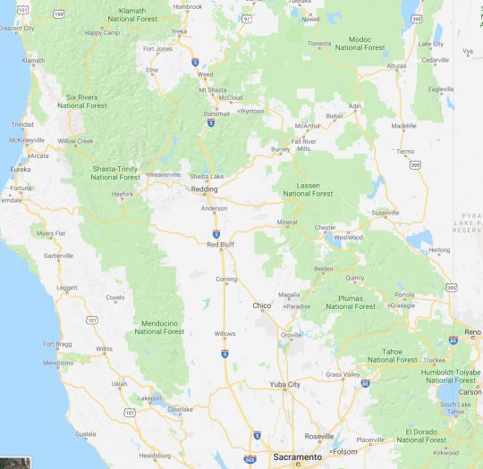
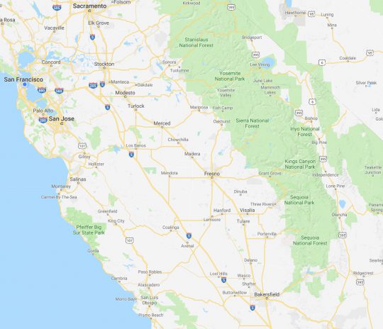
We at CatSynth love traveling and exploring our adopted home state.  This includes day trips from the Bay Area as well as longer adventures.  But one thing remains a bit of a challenge.  For much of the state, the main highways are primarily north-south, with very few east-west routes.  One chooses one of the long-haul north-south highways, California 1, US 101, I-5, California 99, or US 395 and is pretty much locked in with only a few options for efficiently traveling east to west.  There is I-80 in the middle north, California 152 or California 46 from the coast through the Central Valley and California 58/I-40/I-15 further south.


North of Sacramento, east-west travel becomes even more difficult, with routes like California 20 and California 299 being relatively rural and windy for much of their length.  The end result is that most of our trips – especially single-day trips heading north – are forward and back along one of the main north-south routes unless we have extra time or necessity to use the smaller east-west roads.

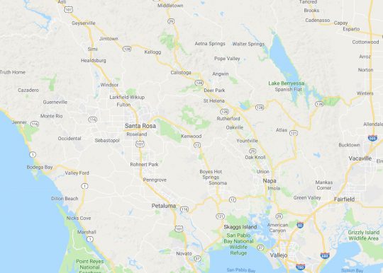
This north-south bias can be seen in an almost self-similar way when zooming in on the extended Bay Area.  South of San Francisco, there is California 1, I-280, US 101, I-880, I-680 and then not much at all until one gets to I-5 in the Central Valley.

In the North Bay and wine country, a similar pattern appears with CA 1, US 101 and CA 29, with another large gap until I-505 and I-5.  We have made use of east-west roads like CA 128 to get between them as in our recent wine-country trip that featured Elsie the Library Cat.  But this is a long detour.

This north-south axis may be frustrating at times (especially the further north one gets), but there is nothing particularly sinister about it.  It’s all a matter of Calfornia’s geology.  The interface of the Pacific and North American plates that give us our reputation for earthquakes also lead to long bands of north-south mountain ranges and valleys.  The Sierra Nevada may be the most dramatic, but it is only one of several that form vertical stripes, with the Central, Sacramento, Salinas, and Napa valleys in between.  The San Francisco Bay can be seen as another such valley in a way, with shallows bounded by high hills running north-south.

The exception to the “north-south rule” can be found south of the San Gabrial mountains and into the desert.  From Los Angeles and San Diego, one can easily travel east-west to the desert towns and to the Arizona border on I-10 and I-8, with a network of other east-west freeways in between.  It is definitely a different experience traveling down there once one gets over the Grapevine or the Tehachapi Pass and into the southern realms.  As for the rest of the state, there is no escaping the geographic reality, so it is best to embrace it, and even enjoy it.

A Day in Wine Country (2018)

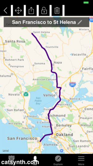
I found myself back again in Napa Valley wine country a couple of weeks ago.  Specifically I was in St. Helena to meet Elsie the Library Cat.  I am not a morning individual, but Elsie apparently is, so at the early hour of 7AM, I headed up from San Francisco, crossing two bridges before exiting the I-80 onto Highway 29.

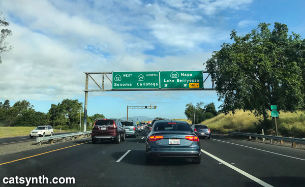
I have written about traveling through the Napa Valley on Highway 29 before, specifically in a post from 2007.  Once again Highway 29, multiplexed with Highway 12, was a parking lot south of the city of Napa, so I was once again able to snap a photo at almost the same exact location.  It was quite theraputic to do so, chasing away some of the demons of 2007, which themselves chased out the demons of 2000.  The road has been upgraded into a better expressway, and Highway 221 (just a short connector to downtown) is now signed.

Highways 29, 12, and 221 in Napa

The traffic thinned out north of Napa as the road narrowed north of Yountville.  Here the landscape is dotted with modest vinyards and over-the-top mansions and tasting rooms.  Finally, I arrived in St. Helena, my favorite town in the region.  I pulled into the library parking lot around 9AM, just in time for my visit with Elsie.

Elsie is a very sweet cat, and quite playful at times despite her advancing age.  With her black coat, she reminded me a bit of Luna, though Elsie has mismatched-colored eyes compared to Luna’s emerald green.   She and the staff of the St. Helena Public Library were great hosts and extremely welcoming of me and my video project.  If you haven’t already seen our CatSynth TV feature on Elsie, you can watch it here.

It was still relatively early when I finished at the library, so I headed to the main street in town for brunch – a protein-heavy heuvos rancheros and some additional coffee seemed like a good idea after the morning video shoot and before heading out for wine tasting.

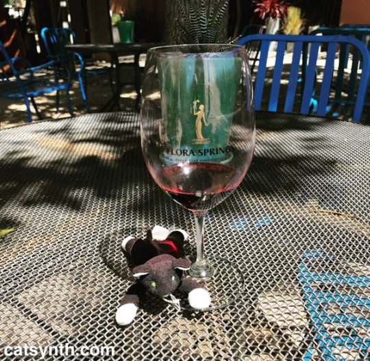
My main winery destination was Flora Springs, also in St. Helena.  In 2014, I had come here for both wine tasting and a photo shoot – you can see one of the photos in this old Wordless Wednesday post.  I had selected it because of the modernist architecture and interior design, but I enjoyed the spicy bold reds as well.  Plus they have a patio that is lovely on a warm afternoon.

Patio at Flora Springs Tasting Room

The same qualities that attracted me to this winery four years ago were in play again – the modern style and bold red wines.  I particularly liked the Trilogy red blend and the Holy Smoke single-vinyard cabernet from Oakville.   This visit was also featured on CatSynth TV.

Having enjoyed a full glass of both the Trilogy and Holy Smoke along with tastings of the standards, I decided I shouldn’t do anymore tasting for a while.  But I still wanted to some more exploring.  So instead of heading straight back south, I turned east onto Highway 128 in Rutherford towards Lake Berryessa, with the goal of finally completing the route.  (Yes, I am weird that way.)
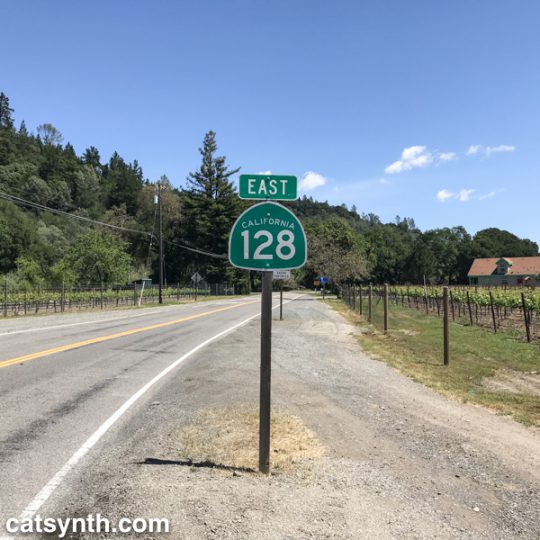
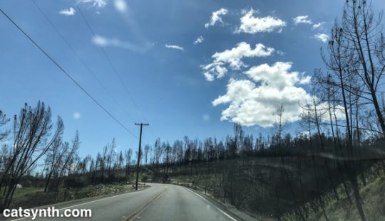
The narrow but well maintained highway took us out of the valley and into the hills to the east, winding our way through several canyons.  The central towns of the Napa Valley were largely spared from last fall’s devasting fires, but here along Highway 128 one could still see some of the scars from the Atlas Fire.  The green wooded hillsides were periodically streaked with bands of ashen gray and bare trees.  But even within those bands, one could see bits of green.  Some of these were trees that were spared during the fire, which jumps from one tree to another, as well as new growth replacing the burns.  It’s amazing to see how quickly nature bounces back, especially compared to human development.  It will take a bit longer to replace the homes, wineries and other businesses, and the mental and emotional scars may never heal.

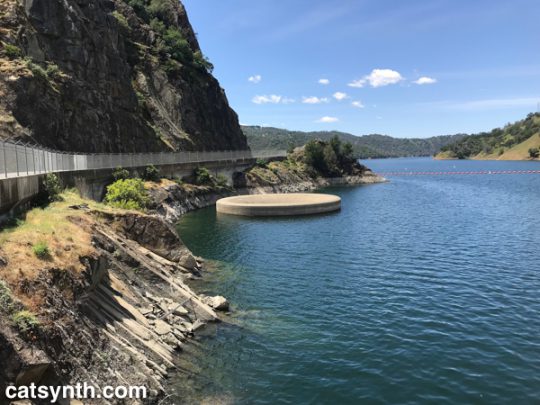
Eventually, the highway aligns to the southern shore of Lake Berryessa, an artificial lake created by damming the Putah Creek.  It’s quite large and major center for water recreation.  I was just there for the visual aspect – I was particularly curious to see the “Glory Hole.”

The Glory Hole, which as also featured in a recent Wordless Wednesday post, is an internal spillway for the reservoir. When the lake gets too full, the water drains out through it like a bathtub.  This happened in 2017, and must have been amazing to see.

We followed the highway down from hills into the Sacramento Valley, where it ends in the town of Winters.  I had stopped here on the way to Portland a few weeks earlier, so had already shot some video.  But that one is still a work in progress…


See more of California’s Napa Valley Wine Country and many other fascinating places in our Highway☆ app, available on the Apple App Store and Google Play Store. 

Highway☆ on Apple App Store    Highway☆ for Android

Wine country

Sitting outside this fine summer evening with a glass of wine reminds me that I haven't written about my trip to the wine country from Memorial Day weekend.

The “wine country” to which I am referring is the Napa Valley, north of San Francisco. (This is not to be confused with the Santa Barbara wine country in Sideways). The heart of the wine country is corridor along highway 29 north of the town of Napa:

I'm not sure why I thought that weekend would be a good time to go. Highway 29 was a parking lot the entire way from its start in Vallejo through at least the town of St. Helena. It is a pretty undersized highway for such a heavy tourist destination, but one can understand why they may not want to expand it too much. It is, however, an expressway and freeway in area in and around the town of Napa (within the city limits, it was a full-on freeway). The reason this photo taken just south of Napa is so clear is because I wasn't moving.

It seems like they should consider upgrading the remainder to a freeway at least through Yountville, which is considered the start of the main wine country. At this point, 29 becomes a two-lane road amongst vinyards, eventually meeting up with highway 128 around St. Helena, which pretty much lives entirely off the wine and wine-tourism industry. 29 and 128 continue north through some of the most upscale vinyards before splitting at the resort town of Calistoga.

One of the main wineries I visited was in fact just a bit south of Calistoga. Clos Pegase was of particular interest not because of the wine per se (though the wine was quite good), but the owner's extensive art collection, mostly 20th century works. Among them are this monumental mobile by George Rickey:

George Rickey's work was familiar, having seen at least one other example at the New Orleans Museum of Art scupture garden during my trip last year.

This linear-geometric piece by Tony Smith really works with the rows of grape vines:

I often try to find just the perfect perspective when confronted with such strong lines. You can see another example (one of my favorite among my “art photos”) from the Getty Center in Los Angeles, one of several on my photography page (which I really need to update one of these days).

Another interesting geomtric metal piece, this one by Joel Shapiro:

Of course, the collection is not just abstract work. There were several figurative pieces as well, including this sculpture by Henry Moore, which appeared to have gotten the “John Ashcroft Treatment”:

Of course, they had wine, too. Of particular note was the cabernet franc. Most American winedrinkers will be familiar with cabernet sauvignon, which are often my favorite wines. “Cab franc” is another grape that is often used in blends, but Clos Pegase's solo version was a great discovery.

The town of Calistoga is perhapsa better known for water than for wine. Calistoga gives its name to brand of mineral water popular here at CatSynth (though they were not offering tours despite the “come visit us sometime” suggestion on the label). It is also known for its many hot springs and spas. But beer? Well, it did try a very distinctive beer from the Russian River (in neighboring Sonoma County), with a rather sweet taste. Ironically, this was at wine bar that I stopped into while spending time until a spa appointment. This particular bar called out to me with its metalic modernist trendy urban look and vibe, compared to the general rustic charm of Calistoga – there is a definite “look” that most resort towns in northern California have that looks like a hybrid of Gold Rush and New Age. Nonetheless, I think I picked the right alternative for myself, and also enjoyed this little pasta-and-goat-cheese nibble.

I definitely recommend a wine-country trip for anyone in the extended Bay Area, though maybe not on the busiest travel weekend of the year. Maybe not a good trip for those who dislike wine, art and spa treatments. We at CatSynth refer to such people as “strange and weird.”