Pick Your Poison: Road Travel in California

We at CatSynth love traveling and exploring our adopted home state.  This includes day trips from the Bay Area as well as longer adventures.  But one thing remains a bit of a challenge.  For much of the state, the main highways are primarily north-south, with very few east-west routes.  One chooses one of the long-haul north-south highways, California 1, US 101, I-5, California 99, or US 395 and is pretty much locked in with only a few options for efficiently traveling east to west.  There is I-80 in the middle north, California 152 or California 46 from the coast through the Central Valley and California 58/I-40/I-15 further south.


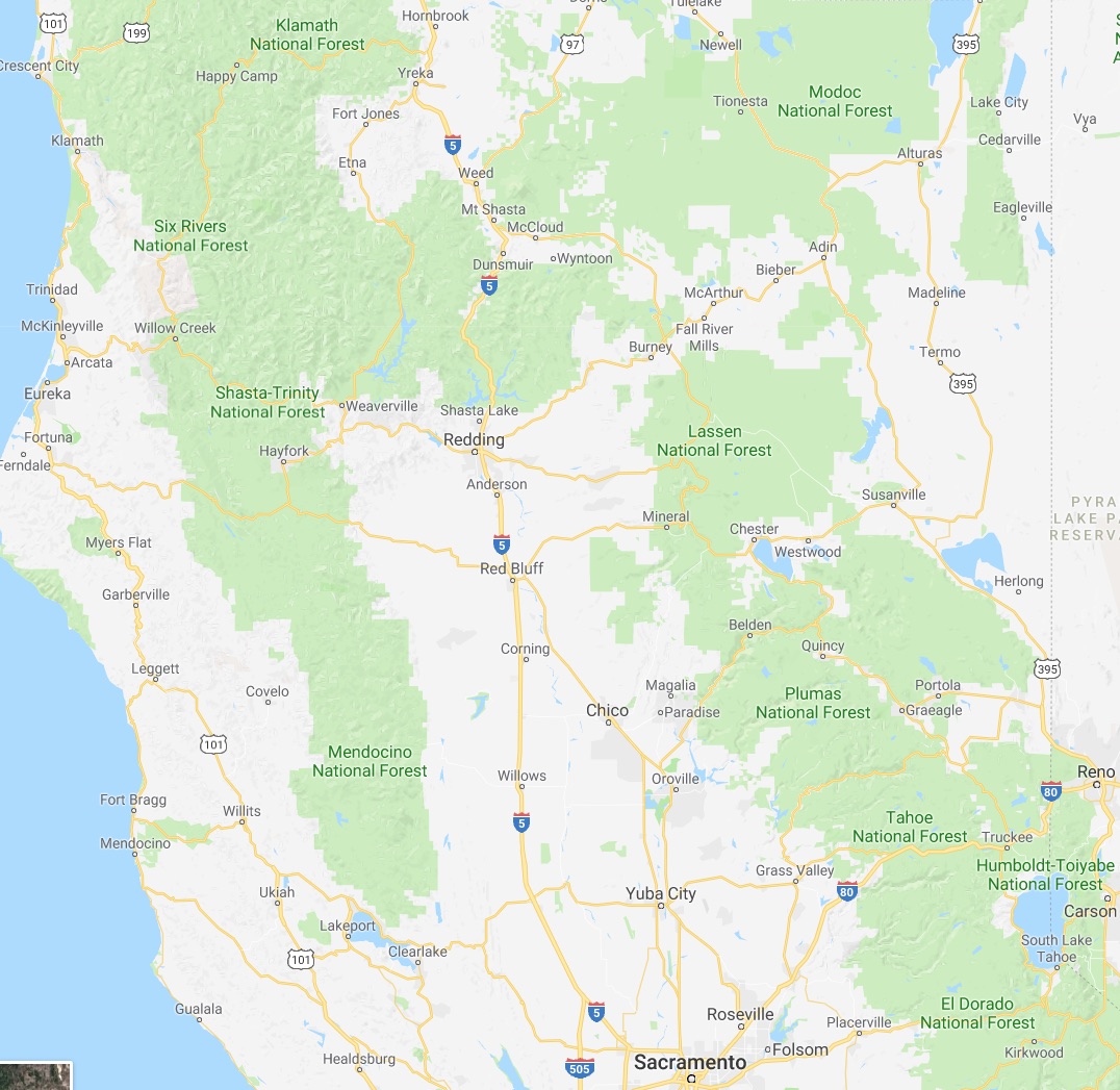
North of Sacramento, east-west travel becomes even more difficult, with routes like California 20 and California 299 being relatively rural and windy for much of their length.  The end result is that most of our trips – especially single-day trips heading north – are forward and back along one of the main north-south routes unless we have extra time or necessity to use the smaller east-west roads.

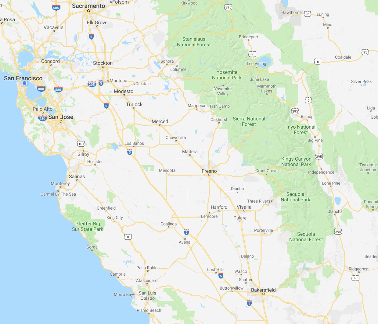
This north-south bias can be seen in an almost self-similar way when zooming in on the extended Bay Area.  South of San Francisco, there is California 1, I-280, US 101, I-880, I-680 and then not much at all until one gets to I-5 in the Central Valley.

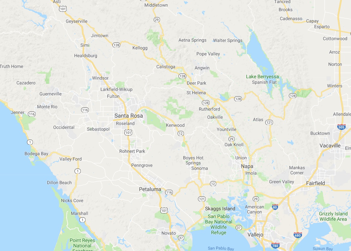
In the North Bay and wine country, a similar pattern appears with CA 1, US 101 and CA 29, with another large gap until I-505 and I-5.  We have made use of east-west roads like CA 128 to get between them as in our recent wine-country trip that featured Elsie the Library Cat.  But this is a long detour.

This north-south axis may be frustrating at times (especially the further north one gets), but there is nothing particularly sinister about it.  It’s all a matter of Calfornia’s geology.  The interface of the Pacific and North American plates that give us our reputation for earthquakes also lead to long bands of north-south mountain ranges and valleys.  The Sierra Nevada may be the most dramatic, but it is only one of several that form vertical stripes, with the Central, Sacramento, Salinas, and Napa valleys in between.  The San Francisco Bay can be seen as another such valley in a way, with shallows bounded by high hills running north-south.

The exception to the “north-south rule” can be found south of the San Gabrial mountains and into the desert.  From Los Angeles and San Diego, one can easily travel east-west to the desert towns and to the Arizona border on I-10 and I-8, with a network of other east-west freeways in between.  It is definitely a different experience traveling down there once one gets over the Grapevine or the Tehachapi Pass and into the southern realms.  As for the rest of the state, there is no escaping the geographic reality, so it is best to embrace it, and even enjoy it.

Fun with Highways: CA 77, Oakland

While shooting photos in an industrial section of East Oakland with a friend a few weeks ago, I came across a surprising section of highway that i had not noticed in the past.

[Click to enlarge.]

It turns out this is CA 77, a short freeway that stretches from International Boulevard, of the main streets in East Oakland, to I-880, and is one of the shortest in the state. It starts at a street intersection with International Boulevard (CA 185), passes underneath San Leandro St and the elevated BART tracks and connects onto I-880 via the ramps (which mark the highway’s end).

The overhead signs are actually hanging from a rail overpass, which I had walked along and was a rich source of photographic material, including a recent Wordless Wednesday photo with graffiti.

Although there is a direct connection from the end of CA 77 to I-880, the converse is not true. There is not even a mention of highway 77 at the closest exist (High Street). However, it looks like there is a lot of construction going on at the now rather old and dilapidated interchange, so there might be a direct and signed connection in the future.

Going east from the San Leandro Street and BART overpasses, the highway has a single intermediate exit to East 12th Street. It then tilts upwards to meet International Boulevard at a traffic light.

[click to enlarge]

International Boulevard (CA 185) used to be known as East 14th Street, and was a rather infamous (and dangerous) corridor in East Oakland. Changing the name 1996 did not really change the situation. But from what I understand, it had been getting better, at least until the recession.

According to the California Highways site, CA 77 is intended to continue further east to I-580, but it appears this is neither constructed nor signed on surface streets.  They also mention that the stretch of freeway had been signed as CA 185 until 2008, and in fact I do recall once or twice seeing a sign to that effect when taking BART sound from Oakland years ago.

Bay Area travel madness

Living in Santa Cruz can be a challenge at times. One of the major challenges is getting to and from places in the Bay Area, where most of my musical, job-search, and social activities located.

For San Francisco trips, one takes Highways 17, 85 and 280 (or 101 as suggested below) into the city:

If I am not in a rush, highway 1 along the coast is always a rewarding experience.

For the east bay (Berkeley, Oakland, etc.), one instead follows highway 17, which becomes I-880, along the east side of the bay:

The trick is avoid the bridges. Sometimes this is unavoidable, and one ends up making a “grand circuit” to and from Santa Cruz around the bay.

The trip is about 70 miles each direction (slightly longer on the east bay side), and about 90 minutes unless one hits bad traffic. Really, it's not so bad, and I have been doing trips like this for years for music and art events, or to see friends, family, and such.

But when it becomes several times a week, and nearing every day, it starts to wear on you. Almost all of my job interviews are in the bay area. Then there is the upcoming performance schedule, back-to-back shows in SF and Oakland followed by the tour.

And this weekend will top them all:

Saturday. Rehearsal for Polly Moller and Company. Then br'er performs in San Francisco that night. It's quite a coincidence that br'er is touring the west coast right now, just as I am about to go on tour. Indeed we will also be crossing paths again in Seattle when we both play on October 20th.

Sunday. Rehearsal again. Then the :plug3: headphone festival in San Francisco. I have a solo set at 7:30PM.

Monday. The tour's kickoff show at 1510 8th Street in Oakland. I have a solo set in addition to our group show.

Tuesday. I need to stay overnight so that…

Wednesday. We leave on tour from SF and Oakland bright and early.

This is out of control. Not because of the activities themselves, which are manageable, but the fact that it is far from CatSynth HQ every day. I have options to stay overnight to make things easier (and will likely do so some of the nights), but that means being away from home, away from everything that needs to be done here, away from Luna (which also means setting up more cat sitting arrangements).

Living in Santa Cruz is becoming one huge liability. It was fine when I was working every day here and going up to the city once a week or so, but now my life and all the action in it seems to be back in the bay area. How long can I keep this up?

Seriousness with Highways: MacArthur Maze

I had planned to do a “fun with highways post” on the MacArthur maze, which connects highways I-80, I-580 and I-880 to the Bay Bridge in Oakland:

Well, it turns out not to be so “fun” at this time. A major tanker truck crash and explosion in the southest corner of the maze. The resulting conflagration on the elevated southbound I-880 melted the steel of the even more elevated eastboard connector from I-80 to I-580, which eventually collapsed onto the lower highway.

Please visit this article to view images. You can see a video taken by an eyewitness at the time of the fire. Watch it here instead of at the YouTube site in order to avoid the boorish and in some cases quite inappropriate comments.

This looks like it was rather intense, and scary. Indeed it was rather freaky to see the charred freeway photos last night when first logged on last night. I know that section of freeway quite well from my time in Berkeley and frequent trips to San Francisco and the East Bay since then. That section of southbound 880 had only re-opened a few years ago, having been closed and then rebuild after the infamous collapse of the 880 double-decker freeway in the 1989 earthquake.

Fortunately, the driver of the truck escaped with only moderate burns, and nobody else was hurt in either the fire or the collapse of the freeway. Presumably when you see something like that ahead of you, you opt not to keep heading into it. The area is also fairly spare industrial land, so no homes in West Oakland were threatened. Could have been a lot worse, I suppose…