This week the primary season brings us to two very different states, each of which are a source of creative inspiration but in very different ways. The first of these states we will visit is Arizona.
 We begin where we left of in Colorado. From Four Corners, we head west on US 160 through the Navajo Nation. The dry landscape is punctuated by red rock formations such as Baby Rocks, which can be seen along the highway.

[By Reinhard Schön (original photograph) and Andreas F. Borchert (postprocessing) [CC-BY-SA-3.0], via Wikimedia Commons]
 The shapes and textures of the rock formations and the sparseness of the landscape are what attract me to the southwest. The unique combinations of climate, water and rock composition lead to this landscape, and individual varieties of rock (many of which are different types of sandstone) lead to the distinctive shapes in different locations. Sometimes the most interesting can simply be found on the side of the road. But that does not detract from the many iconic parks in this state. Indeed, if we continue on US 160 west to its terminus at US 89, and then further west along State Highway 64, we come to the most iconic of all, the Grand Canyon.

[By Tobias Alt (Own work) [GFDL or CC-BY-SA-3.0-2.5-2.0-1.0], via Wikimedia Commons]
It’s quite hard to summarize the Grand Canyon in such a brief article, but to say that it is most defined by its vast size. One is not simply looking at a large rock formation, but an entire carved landscape that extends in all directions. The space left by the canyon is big enough to support the same atmospheric effects as the sky itself, such as the refraction that leads to a blue tint in the space. Sadly, this also makes it a magnet for air pollution. The scale also means that from a distance one sees the rough surface and curved lines of the overall topography, but not as many distinctive formations like the Baby Rocks described above. To see such details of the Grand Canyon, one must travel to the far sections of the rim or descend into the depths.

[Photo by Al_HikesAZ on flickr. (CC BY-NC 2.0)]

[Photo by Al_HikesAZ on flickr. (CC BY-NC 2.0)]
For many, places such as this are as much about recreation (rafting, hiking, climbing), but for me the interest in going back sometime soon is primarily about the visual landscape, touching feeling and breathing the desert air, and hearing both the sounds and the silences.

 We head south from the Grand Canyon on US 180 to I-40 near Flagstaff. We take I-40 east to another of Arizona’s iconic locations, the Petrified Forest National Park. The eponymous petrified trees were created by combination of trees and minerals that were deposited over long periods of time and the gradual replacement of the organic matter with minerals. The relatively soft and easily eroded sandstone have left a surprisingly large number of these artifacts in one location. The extreme erosion patterns of the area also gave rise to the colorful formations of the Painted Desert.

[By User:Moondigger (Own work) [CC-BY-SA-2.5], via Wikimedia Commons]

By Finetooth (Own work) [CC-BY-SA-3.0 or GFDL], via Wikimedia Commons
") Leaving the park, we turn back west on I-40 to Flagstaff, and then head southward on I-17 towards the Phoenix metropolitan area and a very different Arizona. But along the way, we pass by Arcosanti, an experimental town and “urban laboratory” that began construction is 1970. It was started by architect Paolo Soleri to experiment with ways of developing urban environments that minimized the impact on the natural environment. The architecture of Arcosanti is quite unique.
Leaving the park, we turn back west on I-40 to Flagstaff, and then head southward on I-17 towards the Phoenix metropolitan area and a very different Arizona. But along the way, we pass by Arcosanti, an experimental town and “urban laboratory” that began construction is 1970. It was started by architect Paolo Soleri to experiment with ways of developing urban environments that minimized the impact on the natural environment. The architecture of Arcosanti is quite unique.

[By Cody from Phoenix, AZ (arcosanti western half) [CC-BY-2.0], via Wikimedia Commons]
In addition to being an experimental project itself, it hosts a variety of events (including the annual Different Skies Music Festival).
")
[By Cody from Phoenix, AZ (arcosanti apse) [CC-BY-2.0], via Wikimedia Commons]
And it’s on to Phoenix. It’s hard to conceptualize that in the middle of the desert is one of the largest and fastest-growing metropolitan areas in the United States. Yet there it is. The recent rapid growth of Phoenix and the entire “Valley of the Sun” and the relatively flat terrain have led to some rather impressive highway interchanges.


 The rather complex tangle above is the interchange of I-10 (the Papago Freeway coming from downtown Phoenix), Arizona Loop 202 and Arizona State Highway 51, which is supposedly the busiest interchange in the state. A more elegant one (which I have in fact seen in a museum piece) can be found further east where AZ 202 meets US 60.

The lines and curves complement the desert terrain (disregarding the subdivisions for the moment). Indeed, the structures themselves have a reddish color reminiscent of the desert landscape.
Traveling up Arizona Loop 101 to Scottsdale in the northeast corner of the metropolitan are, one finds Taliesin West, the winter home and school of Frank Lloyd Wright. Wright designed this home to reflect “Arizona’s long, low, sweeping lines, uptilting planes”, aspects of the natural landscape which we have explored in this article.

[I, Gobeirne [GFDL, CC-BY-SA-3.0 or CC-BY-2.5], via Wikimedia Commons]
In ways, his goals predate and inform the work that continues at Arcosonti, although the latter has more of an urban focus.
Heading south and east on I-10, we come to Tucson and a very different but still quintessentially “Arizonan” landscape. Here the most distinctive features are not the rocks but the vegetation, especially the saguaro cactus. Like the Grand Canyon, the saguaro is a symbol of the state, and of the best preserved tracts of these and other cacti can be found in Saguaro National Park west of Tucson.

[By Saguaro Pictures (Own work) [CC-BY-3.0], via Wikimedia Commons]

 Heading back west on I-10, we switch to I-8 through the southwest corner of this southwestern state. We turn south on State Highway 85 through relatively empty but rocky landscape. Highway 85 intersects with 86 at the small town of Why, named for the “Y” shape of the original intersection of the two highways. Because Arizona law required location names to have at least three letters, the name “Why” was used instead of “Y”. Continuing south on 85, we eventually reach Organ Pipe Cactus National Monument.

[By Pretzelpaws at en.wikipedia [GFDL], from Wikimedia Commons]
Although this park is named for the organ pipe cactus (shown above), it contains many of the other varieties found in southern Arizona, such as the saguaro. However, the converse is not true. The organ pipe cactus only grows wild here. I visited in the winter of 2004-2005 and found this park to be quite sparse and peaceful. The landscape does not really have many of the monumental rock formations further north, but it does have interesting hillsides covered with rough crumbling stone and frequently punctuated by the cacti.

And I think the final desert sunset is an appropriate way to conclude this article. I of course know there is much more to consider in Arizona, and welcome thoughts and ideas from others as comments.


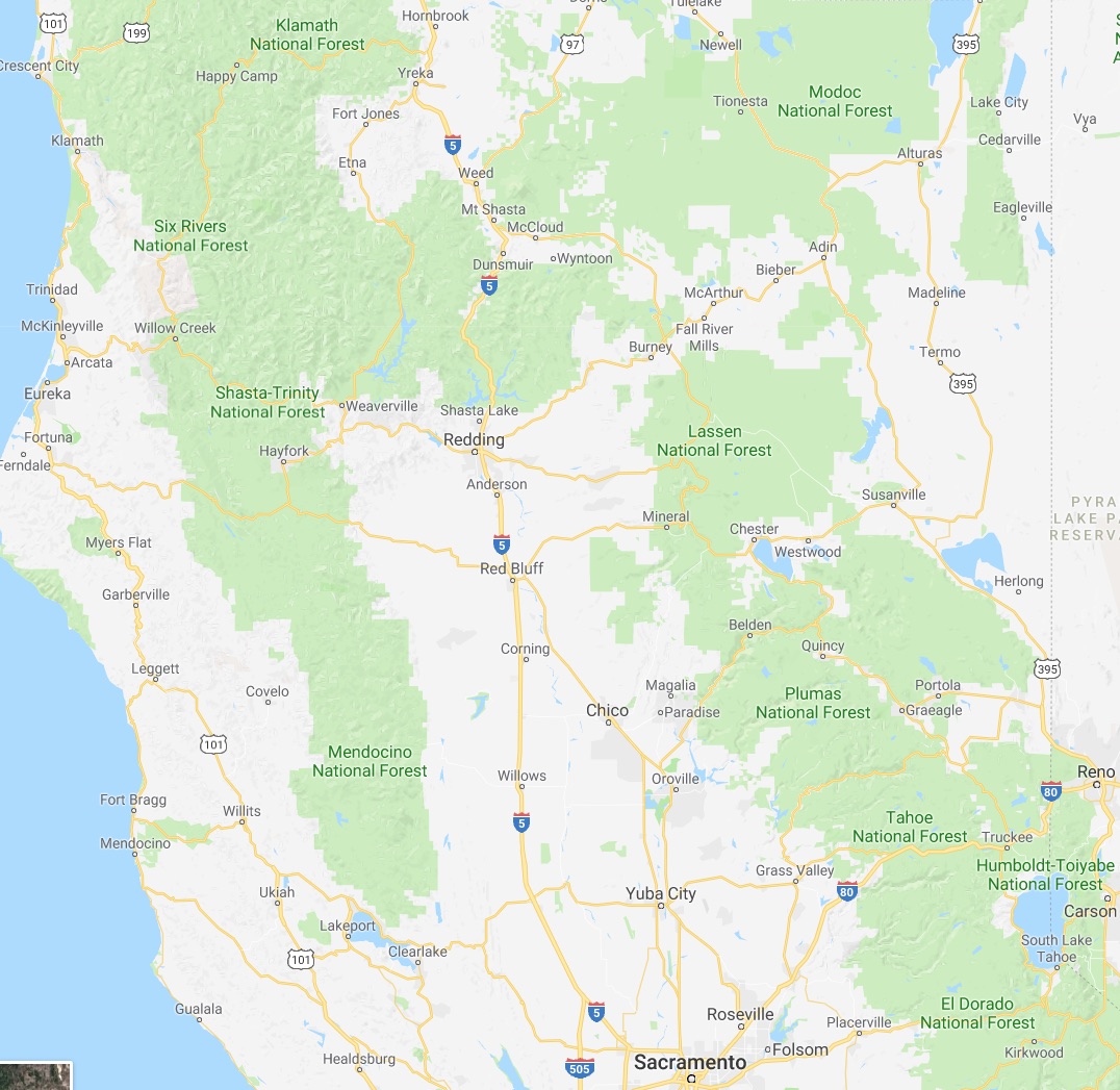
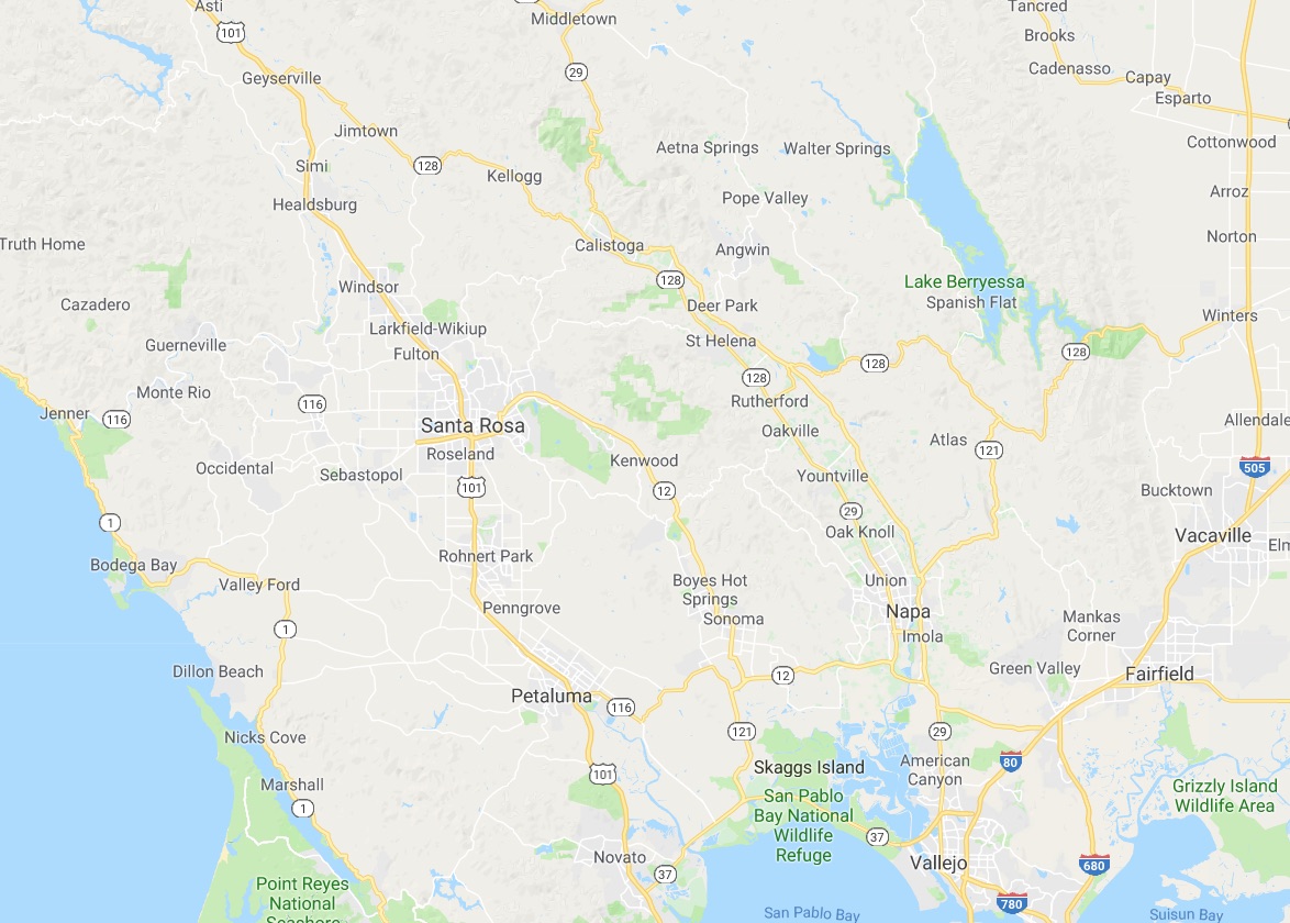
 We at CatSynth love traveling and exploring our adopted home state. This includes day trips from the Bay Area as well as longer adventures. But one thing remains a bit of a challenge. For much of the state, the main highways are primarily north-south, with very few east-west routes. One chooses one of the long-haul north-south highways, California 1, US 101, I-5, California 99, or US 395 and is pretty much locked in with only a few options for efficiently traveling east to west. There is I-80 in the middle north, California 152 or California 46 from the coast through the Central Valley and California 58/I-40/I-15 further south.
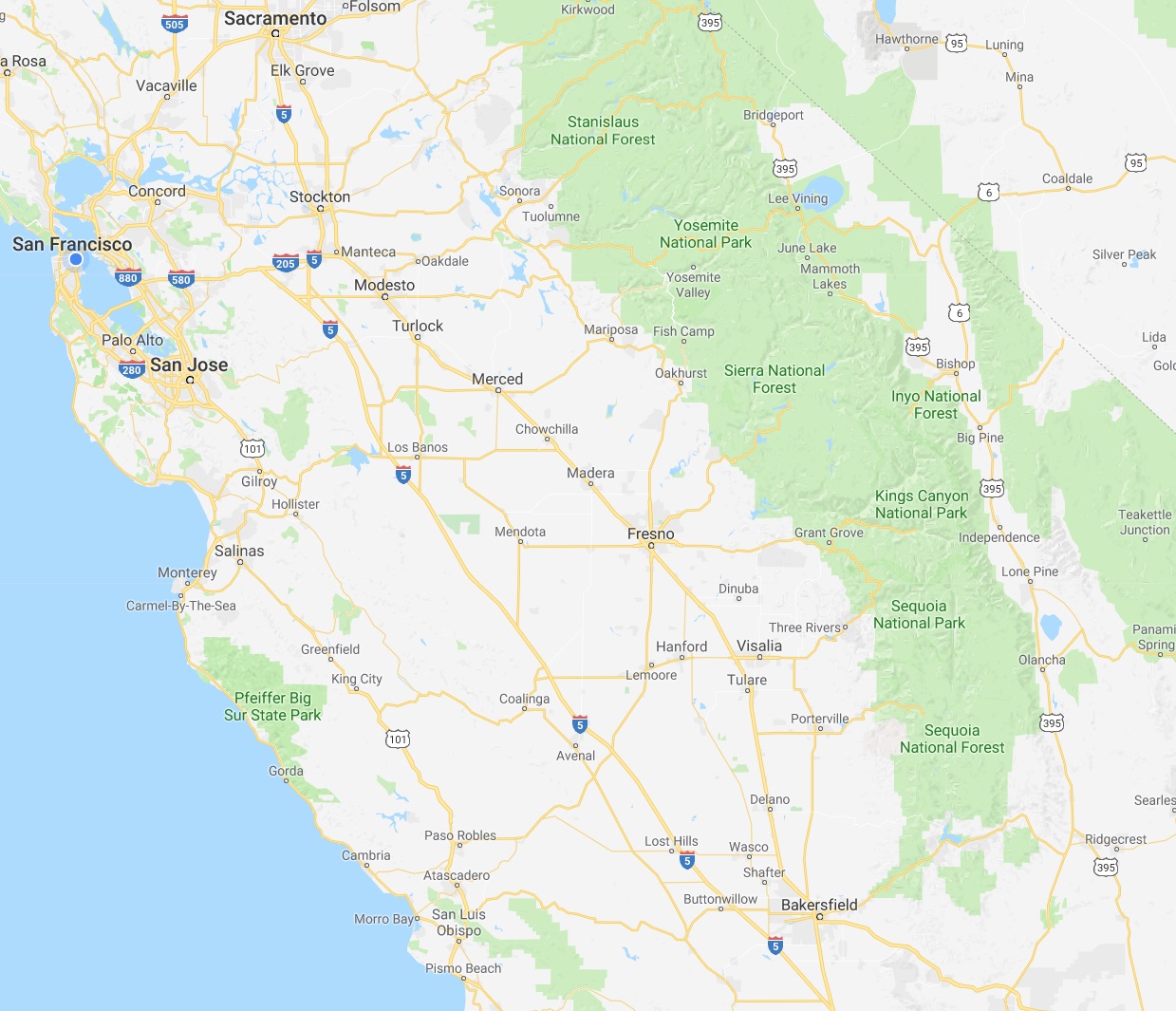


.png)


.jpg)