
One of the happier aspects of my increased leisure time is getting to take more trips, some close to home, some further afield. Last Thursday I found myself not to far from home, traveling one of my favorite stretches of highway along the southern edge of the Monterey Bay.
 Highway 1 becomes a freeway (as it does in many small stretches), between Castroville and the area south of Monterey. I don't think this section has a name, but I think one appropriate name would be the Castroville-Monterey Freeway. And while there are many more spectacular places along Highway 1, this was one of the first drives I did on the coast, and it is also unique for being a “freeway on the beach”, with sand dunes on either side. Signs of the yellow-diamond variety warn motorists of “drifting sands.” This is most noticeable in the towns of Seaside and Sand City, just north of Monterey.

This photo is from AARoads, one of many great sites we at CatSynth turn to for information and fun on highways.
Also from AARoads, one of the major exits along the beach and dunes in Seaside:

Photo by Pete Sison
I would take my own photos, but stopping along the freeway is prohibited, and doubly so if you look to an over-eager CHP officer like you're photographing highway overpasses for the next terrorist attack, and that if he catches a “suspicious middle-eastern-looking guy” he might get a promotion, or even a medal from W. It's just another sad statement of our times. But we're happy to have resources like the folks at AARoads who publish great photos like these.
 Looking from above, one can see the freeway, and some surrounding development, is indeed right on the beach (click the map to enlarge). This includes not only the highway and some resort hotels, but also a huge shopping center, an “auto row” of car dealerships, and indeed much of the commercial development for the town of Seaside. It turns out Seaside is actually larger than Monterey, something I only found out about a year or so ago, and has a lot of the commercial development in the area not directly related to tourism.
More perpexing in some ways is the aptly name town of Sand City. It is an incorporated city, but has a population of under 300. I could never quite figure out what it was about, i.e, why it was a separate town. It's main feature as seen from Highway 1 is a huge shopping center, which I have generally avoid. Sand City's boosters suggest that it is a small but very hip oasis with artists in old industrial buildings, like one might find in trendy sections of New York or San Francisco.
The southern Monterey Bay seems to have had its share of nasty development, despite its current reputation as a resort- and environmentally-conscious area. In addition to Seaside, there were major military installations in the area, and of course the early-20th-century industries in Monterey made famous by John Steinbeck. The area is still recoving in some ways from those scars. One place that seems to be a successful recover project is the Marina Sand Dunes, slightly north in town of Marina. I often stop here on trips when I have some extra time; the sand dunes are quite different from the rest of the mostly-rocky coastline:

click to enlarge
Yes, those sand dunes are actually on the coast. One just was to walk over a small rise for a spectacular view of the dunes and the bay:

click to enlarge
If you look really hard, you might be able to see CatSynth HQ beneath one of those hills across the bay.
 Indeed, the area now seems to focus publicly on its coastline and the bay, with the center of gravity moving to institutions like the Monterey Bay Aquarium, itself on the site of a former factory/cannery. This makes for an interesting mixture of retro-industrial architecture and sea life, both of which rely on simple structures and geometry, and thus great for photography.
Of course, the main attraction at the aquarium as well as area wildlife preserves are the otters. No one can resist otters. No one.

But otters are more than just cute and furry. They're also very informative and entertaining.

Janis Chaffin in MBA's Basta Basura is seen here as Ollie Otter and Freddie Fishie. I believe Basta Basura will be ending its run at the aquarium soon, but I hear they will be available for bar mitzvahs and weddings starting in September.
 Our main road is NY 120 which starts in the nearby community of Millwood (which is actually part of the same town), and continues southeast through the town center of Chappaqua. The main intersection is famously confusing and dangerous and years of trying to install such safety conveniences as a traffic light have met with local resistance. Apparently a traffic light would ruin the character of the town (in a way that car accidents apparently do not). 120 also crosses the Saw Mill Parkway, our nearby excuse for a highway, and the main commuter rail line that passes through town to New York City.


 On this rather dreary and anxious day, we take a few minutes to remember a much happier day from this summer.


 Highway 11 in Connecticut is a north-south freeway connecting a major route from Hartford to, well, nowhere. So one moment, you’re happily traveling south on a nice country highway, and then the next moment, you better exit before it turns into a large dirt track and ditch. Or at least that’s the impression I get, having never been there.
 Finishing my album 2 1/2. There are a few tracks left from this project last Februrary that need to be replaced before releasing the album. I still think I’d doable by late November, but so far I haven’t been able to work much on it during this period of “free time.” Technical problem with my “studio PC laptop” provide at least one excuse.
 Although I have been doing work all along on
  I need to do some revisions to
  I purchased one of the last Kittenettik Fyrall kits from
  The segment of this trip is along I-80, crossing the Bay Bridge and north through Berkeley into the towns of the “North Bay” that always seemed remote even when I was lived in the area. I-80 crosses over the
 .png)
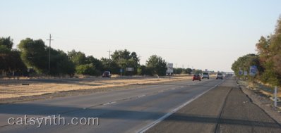
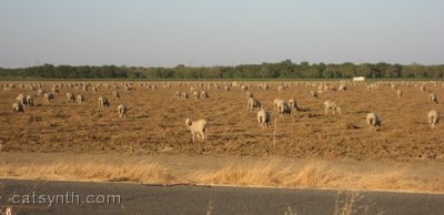
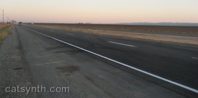
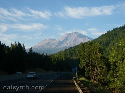
 I-505 soon rejoins the main I-5 freeway coming north from Sacramento towards the Oregon border. Somehow, I-5 manages to appear even flatter than 505:

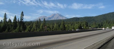
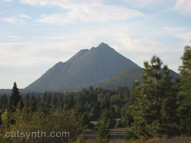


 Highway 1 becomes a freeway (as it does in many small stretches), between Castroville and the area south of Monterey. I don't think this section has a name, but I think one appropriate name would be the Castroville-Monterey Freeway. And while there are many more spectacular places along Highway 1, this was one of the first drives I did on the coast, and it is also unique for being a “freeway on the beach”, with sand dunes on either side. Signs of the yellow-diamond variety warn motorists of “drifting sands.” This is most noticeable in the towns of Seaside and Sand City, just north of Monterey.


