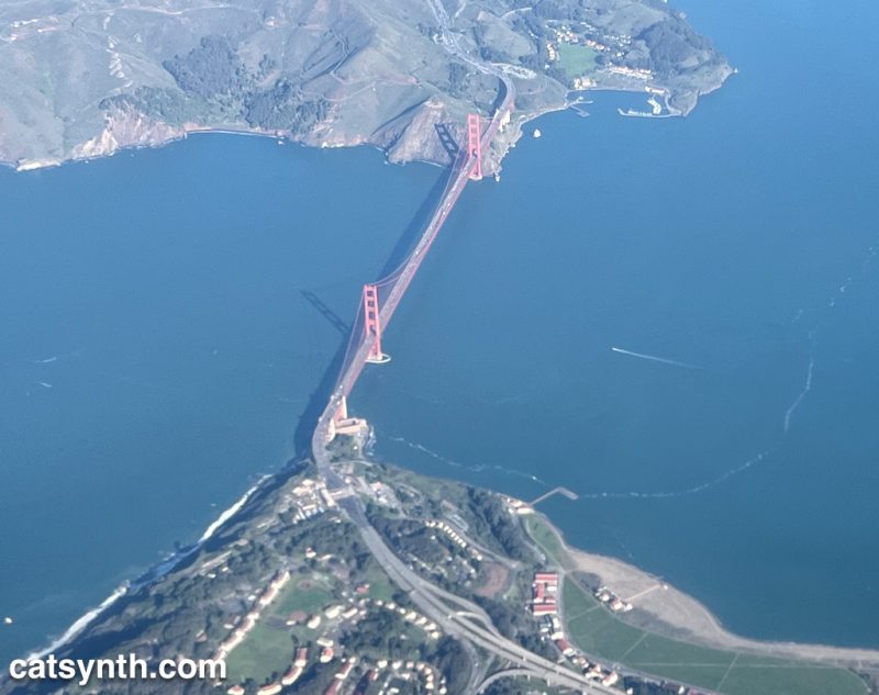
The Golden Gate Bridge, as seen from above on a clear day.


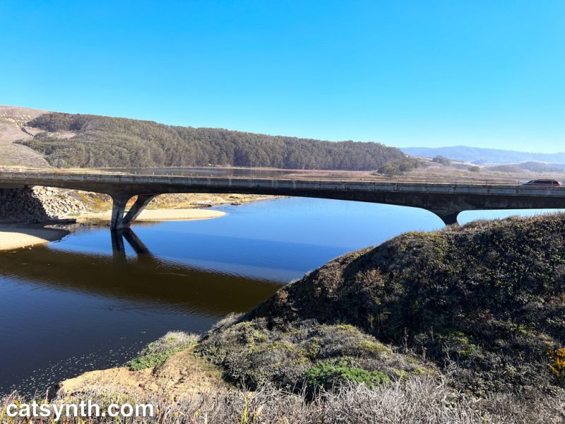
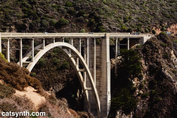
 We at CatSynth love traveling and exploring our adopted home state. This includes day trips from the Bay Area as well as longer adventures. But one thing remains a bit of a challenge. For much of the state, the main highways are primarily north-south, with very few east-west routes. One chooses one of the long-haul north-south highways, California 1, US 101, I-5, California 99, or US 395 and is pretty much locked in with only a few options for efficiently traveling east to west. There is I-80 in the middle north, California 152 or California 46 from the coast through the Central Valley and California 58/I-40/I-15 further south.
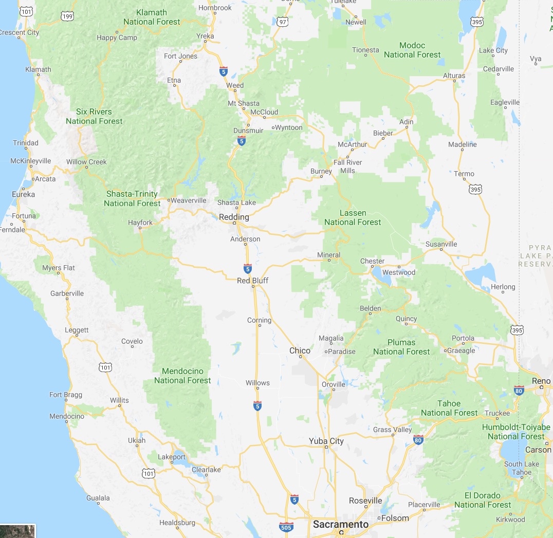
North of Sacramento, east-west travel becomes even more difficult, with routes like California 20 and California 299 being relatively rural and windy for much of their length. The end result is that most of our trips – especially single-day trips heading north – are forward and back along one of the main north-south routes unless we have extra time or necessity to use the smaller east-west roads.


 This north-south bias can be seen in an almost self-similar way when zooming in on the extended Bay Area. South of San Francisco, there is California 1, I-280, US 101, I-880, I-680 and then not much at all until one gets to I-5 in the Central Valley.
.png)
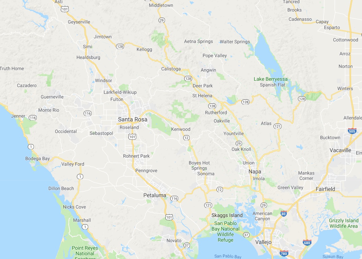
 In the North Bay and wine country, a similar pattern appears with CA 1, US 101 and CA 29, with another large gap until I-505 and I-5. We have made use of east-west roads like CA 128 to get between them as in our recent wine-country trip that featured Elsie the Library Cat. But this is a long detour.
This north-south axis may be frustrating at times (especially the further north one gets), but there is nothing particularly sinister about it. It’s all a matter of Calfornia’s geology. The interface of the Pacific and North American plates that give us our reputation for earthquakes also lead to long bands of north-south mountain ranges and valleys. The Sierra Nevada may be the most dramatic, but it is only one of several that form vertical stripes, with the Central, Sacramento, Salinas, and Napa valleys in between. The San Francisco Bay can be seen as another such valley in a way, with shallows bounded by high hills running north-south.
The exception to the “north-south rule” can be found south of the San Gabrial mountains and into the desert. From Los Angeles and San Diego, one can easily travel east-west to the desert towns and to the Arizona border on I-10 and I-8, with a network of other east-west freeways in between. It is definitely a different experience traveling down there once one gets over the Grapevine or the Tehachapi Pass and into the southern realms. As for the rest of the state, there is no escaping the geographic reality, so it is best to embrace it, and even enjoy it.
 The geography of San Francisco is complicated, and the east and west sections of the city can sometimes seem quite divided. This is even more so when one is transporting a cat across the city, as I did on Thursday to bring Sam Sam from CatSynth HQ in the downtown area to our longtime vets at Especially Cats Veterinary Hospital in the western Sunset District. There are several tall hills in between, and the most efficient route is to hop on I-280 around the southern portion of the city and then up into the Sunset.


 The Sunset is an interesting and intriguing place, almost a separate city. From 19th Avenue (CA 1), the alphabetically arranged streets and numerically arranged avenues slope gently down towards the Great Highway and the ocean. The Great Highway should be CA 35 all the way up to its northern end, rather than ending in the southern corner of the city along Sloat, but it does. Especially Cats is on Taraval Street, one of the main east-west strips in the neighborhood. It even boasts a streetcar line down to the sea.

 This photo was from 2015 when I brought Luna in for her biopsy. It was a normal overcast gray summer day in the Sunset. Sam Sam’s visit was on a hazy sunny and warm day at the start of the current heatwave. The return to Especially Cats was a warm experience as well, albeit a bit emotional as it was our first reunion since Luna passed away. Fortunately, Sam Sam received a clean bill of health and charmed the staff with her cuteness. And she was remarkably well behaved on the trip over, just complaining a little bit. We decided to take the more geometrically direct but hilly and windy route back, taking Taraval to its eastern end a swanky neighborhood around Laguna Honda, and then over Portola and Market back to our corner of the city. The spot where Market and Portola meet is among my favorite in the city, with commanding views of downtown and beyond. And in between, there are dips and valley with unexplored roads and walks that I need to come back to when I don’t have an impatient cat in a carrier.

The whole of the city used to be mine, as I regularly moved from neighborhood to neighborhood for work, fun, or errands. Downtown San Francisco can be a bit of a gravity well when one both works and lives there. It’s a fine situation, in truth, but I can sometimes get a bit restless to move about rest of the city again. Especially some of the older sections, or the more industrial spaces that formed the backbone of my visual art (and “Wordless Wednesday”) but are rapidly disappearing. When will the last dilapidated warehouse give way to a banal medium-rise apartment building?
Finding this balance, doing all we want to do, and have to do, is perhaps this moment’s biggest challenge. But on this day I was happy to simply do right by a loved one while exercising a bit of the wanderlust.
Please check out our Highway☆ app, available in both the Apple App Store and Google Play Store!
My eccentric long-standing fascination with numbered highways has long been reflected on this site. Here we see Luna contemplating a couple of our most recent sign acquisitions.

So what exactly do we do with these? Well, besides just the human tendency to collect things of interest, I have used signs in artwork, photography, video and I am now expanding into more modes of live performance. Mostly, dealers advertise these as “perfect for your man cave”, something which does not interest us at CatSynth in any way. For Luna, they are just more strange objects that pass through her territory. And great neck scratchers.
Today we at CatSynth and countless others celebrate the 75th Anniversary of the Golden Gate Bridge.
![]()
The tallest suspension bridge in the United States, the second longest, and painted in International Orange, it is instantly recognizable. In a sense, the Golden Gate Bridge is San Francisco’s “Empire State Building”. Both are iconic architectural centerpieces that represent their respective cities, and both date back to the 1930s and feature the distinctive Art Deco elements of the era. Both are often present in the background during everyday life of the cities. And (at least for me), they are also places rarely visited except when hosting out-of-town visitors.
 But the Golden Gate Bridge is an important practical part of the city. It is a busy transportation carrying US 101 and California Highway 1 north from San Francisco into Marin County and points beyond on the north coast. It is very unusual for a modern roadway in that the opposing lanes are separated only by short poles that are moved to adjust the number of lanes in each direction. It seems a bit quaint, in fact. On the city side, the highway split into a boulevard carrying CA 1 south and Doyle Drive (US 101) until this past month when the latter was demolished. From these points, travelers are dispersed onto the city streets of San Francisco. There is no easy highway or rail connection between my part of the city (near the Bay Bridge) and the Golden Gate Bridge, owing to the city’s hilly geography and quirky political history. As such, I find myself not near the bridge very often except when I need to be. But when I am nearby it is worth stopping to take notice.

This is what we most often see when we look at the bridge, the orange structure partially shrouded or occasionally completely enveloped by another of our famous landmarks, the San Francisco fog. But the interplay of the fog, the bridge structure, and the other natural and human elements of landscape can make for interesting compositions.

With the anniversary upon us, much attention is being paid to the history of the bridge, its engineering as well as the politics and economics surrounding its construction. For me, the most interesting part of the history is the work of Charles Ellis, a senior structural engineer and mathematician. In many ways (including his early academic credentials), he was more mathematician than engineer, and did much of the theoretical work on the design of the bridge with large amounts of detailed mathematics, along the way publishing highly cited works such as “Williot Equations for Statically Indeterminate Structures” in Transactions, American Society of Civil Engineers, 1935. Indeed, he is now recognized as a principal designer of the bridge, but at the time he was not given any credit after being fired by Joseph Strauss, chief engineer of the bridge project. He was only officially given credit in 2007 (as described in this San Francisco Chronicle article).
This film from the time chronicles the building of the bridge, but also exemplifies the mythology that Strauss created around himself.
Nonetheless, the bridge itself opened to huge fanfare, as seen in this Prelinger Archives film:
Another copy of this video can be found here.
The festivities for this year’s 75th anniversary began about a month ago with the demolition of Doyle Drive, the elevated highway connecting to the bridge.

[Photo by toyzrus8 on flickr. (CC BY-NC 2.0)]
The old highway had elements such as metallic beams in the International Orange color that connected it to the bridge, and it definitely looked to be of the same vintage. It is being replaced by the new Presidio Parkway that will more gracefully connect to the surrounding parkland but also contain the iconic orange color and architectural elements to connect it to the bridge.
Today’s festivities include a planned fireworks display at the bridge. Perhaps most notably there is an ongoing art exhibit at Fort Point called International Orange in which several prominent artists present works inspired by the bridge. I am hoping to see this exhibit soon (perhaps on a quieter day when I can observe the pieces in detail). I did see a preview recently at one of last weekend’s art fairs where Anandamayi Arnold wore one of her dresses for the exhibit, appropriately colored in International Orange. I am also inspired by the concept of this project and the mathematical work of Ellis described above to try my own hand at a creative piece in honor of this occasion.
Please join us in wishing the Golden Gate Bridge a happy 75th Anniversary!
Today’s combined Weekend Cat Blogging and Photo Hunt features the theme of ONE.

Of course, there is only one Luna. No one can dispute that. And this particular pose features one paw sticking out.
We also veer away from cats and into the realm of highways with California Highway 1. This view from Pescadero (between San Francisco and Santa Cruz) is a quintessential image of our coastal highway.

This one is further north, crossing over a harbor in Fort Bragg, in Mendocino County.

Although thought am sure I have lots of images of Highway 1, they have become rather hard to keep track of in the ever increasing library. (It’s hard to keep track of all the Luna photos as well, for that matter.) Tagging and naming files does help, but I would like to use image similarity search as well. Does anyone have any suggestions for this?
Weekend Cat Blogging #323 is hosted by Samantha and Clementine at Life from a Cat’s Perspective
The Photo Hunt #278 is hosted by tnchick. This week’s theme is one.
The Carnival of the Cats will be hosted this Sunday by Nikita and Elvira at Meowsings of an Opinionated Pussycat.
And the Friday Ark is at the modulator.