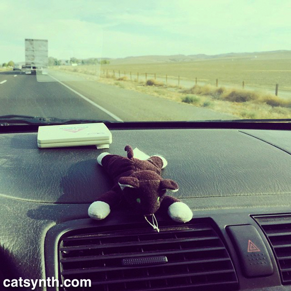
We at CatSynth love traveling and exploring our adopted home state. This includes day trips from the Bay Area as well as longer adventures. But one thing remains a bit of a challenge. For much of the state, the main highways are primarily north-south, with very few east-west routes. One chooses one of the long-haul north-south highways, California 1, US 101, I-5, California 99, or US 395 and is pretty much locked in with only a few options for efficiently traveling east to west. There is I-80 in the middle north, California 152 or California 46 from the coast through the Central Valley and California 58/I-40/I-15 further south.
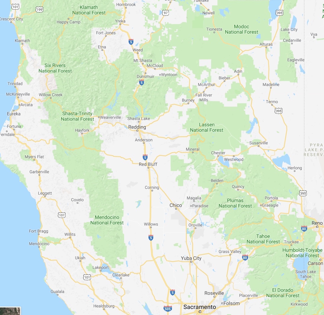
North of Sacramento, east-west travel becomes even more difficult, with routes like California 20 and California 299 being relatively rural and windy for much of their length. The end result is that most of our trips – especially single-day trips heading north – are forward and back along one of the main north-south routes unless we have extra time or necessity to use the smaller east-west roads.
This north-south bias can be seen in an almost self-similar way when zooming in on the extended Bay Area. South of San Francisco, there is California 1, I-280, US 101, I-880, I-680 and then not much at all until one gets to I-5 in the Central Valley.
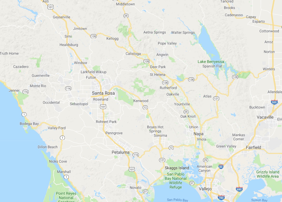
In the North Bay and wine country, a similar pattern appears with CA 1, US 101 and CA 29, with another large gap until I-505 and I-5. We have made use of east-west roads like CA 128 to get between them as in our recent wine-country trip that featured Elsie the Library Cat. But this is a long detour.
This north-south axis may be frustrating at times (especially the further north one gets), but there is nothing particularly sinister about it. It’s all a matter of Calfornia’s geology. The interface of the Pacific and North American plates that give us our reputation for earthquakes also lead to long bands of north-south mountain ranges and valleys. The Sierra Nevada may be the most dramatic, but it is only one of several that form vertical stripes, with the Central, Sacramento, Salinas, and Napa valleys in between. The San Francisco Bay can be seen as another such valley in a way, with shallows bounded by high hills running north-south.
The exception to the “north-south rule” can be found south of the San Gabrial mountains and into the desert. From Los Angeles and San Diego, one can easily travel east-west to the desert towns and to the Arizona border on I-10 and I-8, with a network of other east-west freeways in between. It is definitely a different experience traveling down there once one gets over the Grapevine or the Tehachapi Pass and into the southern realms. As for the rest of the state, there is no escaping the geographic reality, so it is best to embrace it, and even enjoy it.
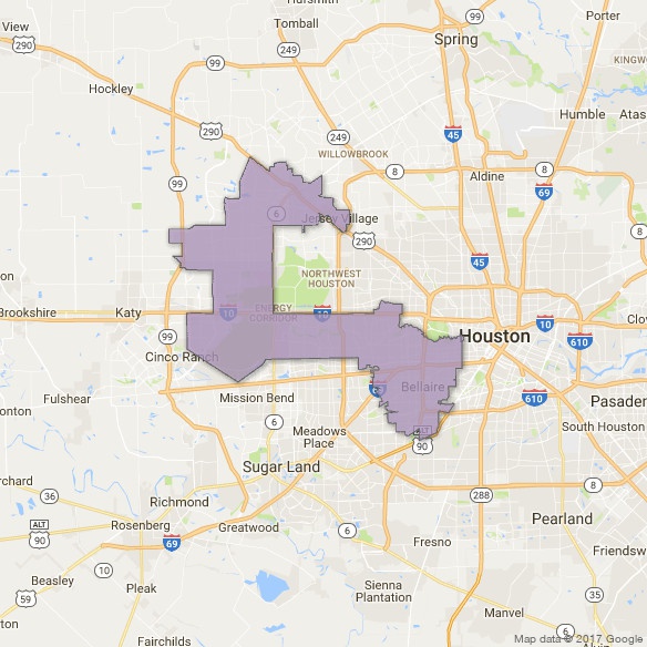
Primary election season is in full swing. In a couple weeks, we will be having one here in California (as well as an election for mayor here in SF). But tomorrow, there is a runoff in Texas’ 7th Congressional District (TX07) in which we at CatSynth are taking a keen interest. As illustrated in the map, TX07 cuts an odd shape through the western neighborhoods of Houston and the adjacent towns in Harris County. It is a diverse area and intersects with all three of Houston’s loop highways, which is no small feat. It includes several wealthy enclaves, but also middle-class neighborhoods, and areas that have been hit by serious flooding during Hurricane Harvey and preceding events.
The southeast “bulge” part of the district includes sections of Houston that lie within the I-610 loop, or “Inner Loop”. I-610 separates the downtown sections of Houston from outer neighborhoods and surrounding communities, including towns like Southside Place. It is bisected west-to-east by the new I-69 (US 59). The area where these two highways intersect would not look out of place in Los Angeles.
Heading north and west, we come to the middle section of the district, which is largely a horizontal rectangle bounded by the mighty I-10 to the north, and which extends almost to Katy in the west. Beltway 8, also known as the Sam Houston Parkway/Tollway, bisects this segment of the district. Just to the west of the beltway are the Briarforest neighborhood and the ominously named Energy Corridor. Not surprisingly, several major energy corporations have operations in this area, as do several other businesses. The Buffalo Bayou – we at CatSynth are still not entirely sure what separates a bayou from a river – cuts through the district. It was subject to major flooding during Hurricane Harvey. In addition to the bayou itself cresting at record levels above flood stage. releases from the Barker Reservoir caused severe flooding in adjacent low-lying neighborhoods. We have sources that have informed us that the floodwaters in the Energy Corridor area were most unpleasant.
The final section of the district cuts an inverted “L” between State Highway 6 and State Highway 99, the outermost loop around Houston, bounded on top by US 290. In all, the district has an odd shape indeed, but not so odd when one considers the tradition of gerrymandering, an art which has been taken to new heights by Texas’ Republican-controlled state government. Its shape has long preserved it as a safe Republican district – it has elected Republicans to Congress consistently since George H.W. Bush in 1966. But the city and surrounding area have been changing, and it is seen as vulnerable to flip to 2018.
Several Democratic candidates have vied to take on incumbent Republican John Culbertson, including Laura Moser, a progressive candidate who also just happens to be the sister-in-law of CatSynth author and founder Amanda Chaudhary. As such, we are watching her candidacy with great interest and excitement. Leading up to the main primary in March, things got a bit nasty, with the DCCC (Demoncratic Congressional Campaign Committee) throwing its weight behind another candidate, more mainstream and connected to the Democratic establishment. This was an unusual move for a suburban primary election, and some of the opposition was rather mean-spirited. But that is a long-standing part of elections, and it only served to galvanize support for Moser, who placed second in the crowded field and made to the runoff which happens tomorrow, May 22. Not having learned their lesson the first time, the DCCC has continued to attack her, including some rather nasty opposition-research-style drops (in some ways, they reminded me of some recent attacks on Jane Kim on our local mayor’s race in SF). But in this case, it was against family, and therefore personal in addition to being against my political views. So we at CatSynth are pulling strongly for Laura Moser in Texas’ 7th Congressional District tomorrow, and hope she wins both the runoff and the general election in November. You can find out more about her history and positions on her website, and if you have any friends in TX07, please encourage them to get out and vote!
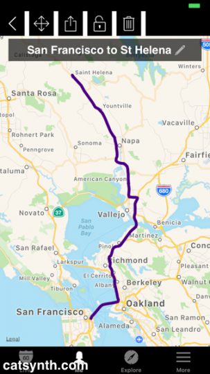
I found myself back again in Napa Valley wine country a couple of weeks ago. Specifically I was in St. Helena to meet Elsie the Library Cat. I am not a morning individual, but Elsie apparently is, so at the early hour of 7AM, I headed up from San Francisco, crossing two bridges before exiting the I-80 onto Highway 29.
I have written about traveling through the Napa Valley on Highway 29 before, specifically in a post from 2007. Once again Highway 29, multiplexed with Highway 12, was a parking lot south of the city of Napa, so I was once again able to snap a photo at almost the same exact location. It was quite theraputic to do so, chasing away some of the demons of 2007, which themselves chased out the demons of 2000. The road has been upgraded into a better expressway, and Highway 221 (just a short connector to downtown) is now signed.
The traffic thinned out north of Napa as the road narrowed north of Yountville. Here the landscape is dotted with modest vinyards and over-the-top mansions and tasting rooms. Finally, I arrived in St. Helena, my favorite town in the region. I pulled into the library parking lot around 9AM, just in time for my visit with Elsie.
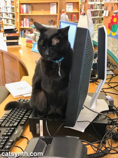
Elsie is a very sweet cat, and quite playful at times despite her advancing age. With her black coat, she reminded me a bit of Luna, though Elsie has mismatched-colored eyes compared to Luna’s emerald green. She and the staff of the St. Helena Public Library were great hosts and extremely welcoming of me and my video project. If you haven’t already seen our CatSynth TV feature on Elsie, you can watch it here.
It was still relatively early when I finished at the library, so I headed to the main street in town for brunch – a protein-heavy heuvos rancheros and some additional coffee seemed like a good idea after the morning video shoot and before heading out for wine tasting.
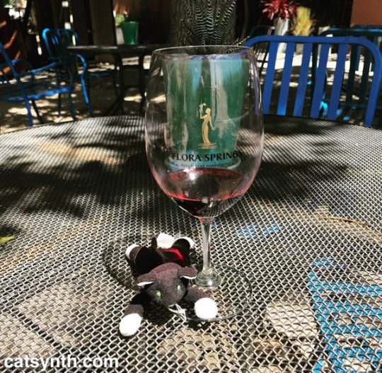
My main winery destination was Flora Springs, also in St. Helena. In 2014, I had come here for both wine tasting and a photo shoot – you can see one of the photos in this old Wordless Wednesday post. I had selected it because of the modernist architecture and interior design, but I enjoyed the spicy bold reds as well. Plus they have a patio that is lovely on a warm afternoon.
The same qualities that attracted me to this winery four years ago were in play again – the modern style and bold red wines. I particularly liked the Trilogy red blend and the Holy Smoke single-vinyard cabernet from Oakville. This visit was also featured on CatSynth TV.
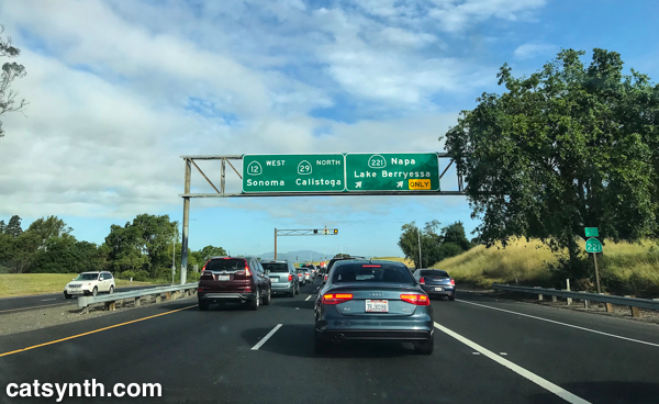
Having enjoyed a full glass of both the Trilogy and Holy Smoke along with tastings of the standards, I decided I shouldn’t do anymore tasting for a while. But I still wanted to some more exploring. So instead of heading straight back south, I turned east onto Highway 128 in Rutherford towards Lake Berryessa, with the goal of finally completing the route. (Yes, I am weird that way.)
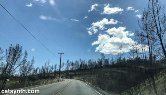
The narrow but well maintained highway took us out of the valley and into the hills to the east, winding our way through several canyons. The central towns of the Napa Valley were largely spared from last fall’s devasting fires, but here along Highway 128 one could still see some of the scars from the Atlas Fire. The green wooded hillsides were periodically streaked with bands of ashen gray and bare trees. But even within those bands, one could see bits of green. Some of these were trees that were spared during the fire, which jumps from one tree to another, as well as new growth replacing the burns. It’s amazing to see how quickly nature bounces back, especially compared to human development. It will take a bit longer to replace the homes, wineries and other businesses, and the mental and emotional scars may never heal.
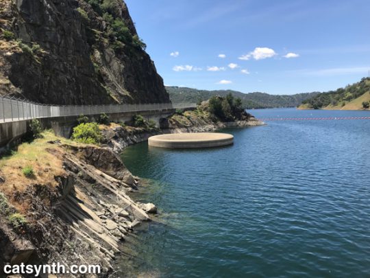
Eventually, the highway aligns to the southern shore of Lake Berryessa, an artificial lake created by damming the Putah Creek. It’s quite large and major center for water recreation. I was just there for the visual aspect – I was particularly curious to see the “Glory Hole.”
The Glory Hole, which as also featured in a recent Wordless Wednesday post, is an internal spillway for the reservoir. When the lake gets too full, the water drains out through it like a bathtub. This happened in 2017, and must have been amazing to see.
We followed the highway down from hills into the Sacramento Valley, where it ends in the town of Winters. I had stopped here on the way to Portland a few weeks earlier, so had already shot some video. But that one is still a work in progress…
See more of California’s Napa Valley Wine Country and many other fascinating places in our Highway☆ app, available on the Apple App Store and Google Play Store.
A week ago, I found myself back in Portland for the first time in four years. Officially, I was there to headline the Volt Divers Cat-tasticEdition show, but geat many other experiences large and small framed the main event. There were synths, cats, food, drink, and rain. Lots of cold rain. And wind. This is not unusual, but it did limit outdoor activities such as industrial and architectural photography. Instead, we enjoyed some of Portlanders’ favorite indoor activities, starting with brunch.
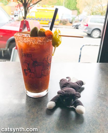
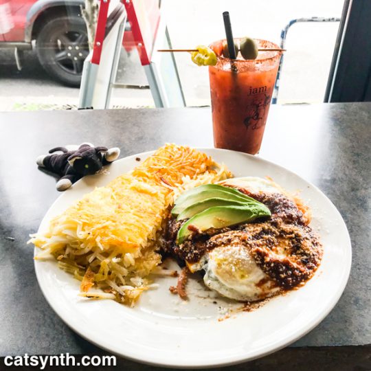
Portland may be an even “brunchier” place than San Francisco, Oakland, or Brooklyn, judging by the lines I observed at popular spots, including Jam on Hawthorne, not far from my home base in Southeast. Fortunately, as a solo patron who doesn’t mind squeezing into a tight spot at the bar, I didn’t have long to wait to get served. I quite enjoyed the spicy bloody-mary variant with Jam’s proprietary “aardvark sauce”, as well as the rancheros.
The sharper cheese sprinkled on top gave the dish an almost Italian quality, but it retained the hearty beans, spicy sauce, and simple eggs that made it perfect for a cold morning. The view out to Hawthorne Boulevard displayed some of the local flavors, including that Charlie-Brown-inspired van in the first photo.
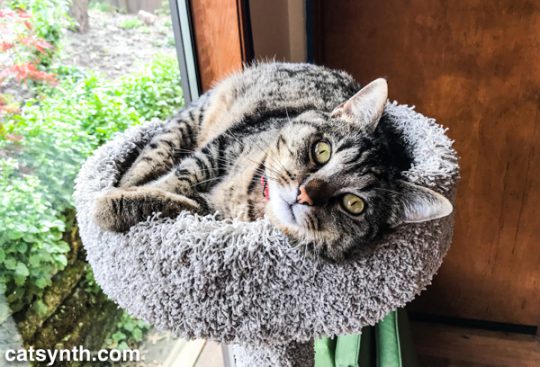
Then it was back to our temporary “CatSynth HQ” to relax for a bit. Buddha, one of my hosts, made sure I felt at home. He was rather friendly, and even demanding of attention. I was happy to oblige.
After some quality cat time, it was back out to Hawthorne, this time headed over the bridge to downtown. Downtown Portland is somewhere between the downtown sections of Oakland and Brooklyn in terms of cityscape and vibe, though on a smaller scale than the latter. It has a regular grid cut by the I-405 freeway and Burnside Street, and a mix of contemporary, mid-century and older buildings. It was at the base of one of the older buildings that I found a small hair salon that was able to fit me in for a last-minute blowout – the weather was not kind to my hair, and I needed to look purrfect for the show that evening.
The next stop took me eastward from downtown to the ragged edges of the city along SE 82nd Avenue (State Route 213). I was here to pick up a borrowed Nord for the show. A mixture of auto-shops, low-rise apartments, and shopping centers made this area feel more like Los Angeles (except for the weather) or the far eastern sections of Queens. But it was still fascinating in its way, and there was an interesting row of shops, bars, and eateries along Stark Street – I wish I had a chance to stop at The Country Cat, but time did not permit this.
With hair done and keyboard secured, it was time to prepare for the show, which back in the industrial section of Southeast along the river at The Lovecraft Bar.
Inside the bar, it was dark. Really dark. It took me a few minutes before my eyes adjusted and I could see everyone else busily setting up their mostly modular rigs. It was all business after that as I set up for the show, but I did have some moments to check out the Lovecraft and horror-themed decor.
I will be covering the show itself in detail in a subsequent article. But we already have a video published on CatSynth TV, which you can view below.
The next morning I found myself in the Hollywood neighborhood. It was actually the first time on this particular trip that I found myself north of Burnside in the northeast sector of the city. Sandy Boulevard was lined with a diverse collection of low-rise businesses. I crossed I-84/US 30 into the adjacent Grant Park district, which reminded me again of residential neighborhoods with larger lots at the edges of New York City into Westchester and Long Island. I had some personal appointments that morning but then remained in Northeast to visit House of Dreams cat shelter at their secure undisclosed location.
House of Dreams is a no-kill shelter specializes in cats that have difficulty finding homes and has space dedicated for FelV-positive cats (i.e., those with feline leukemia). Our show the night before raised funds for their shelter and work, and I of course wanted to come visit the kitties. We will dedicate an upcoming article and video entirely to House of Dreams, but for now here is a cute picture of Flicka, one of the many sweet cats I met there.
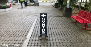
We then hopped onto I-84 back west towards the river, passing the convention center and on to Mississippi Street, a trendy area of boutiques, pubs, and restaurants. This is also the home of Control Voltage, a premier shop for synthesizers of all sorts. It was relatively easy to find with the sidewalk signage.
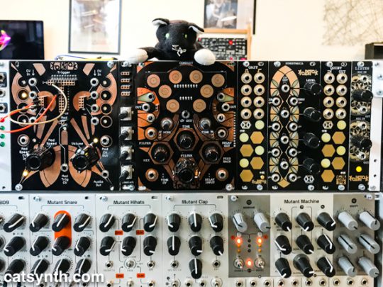
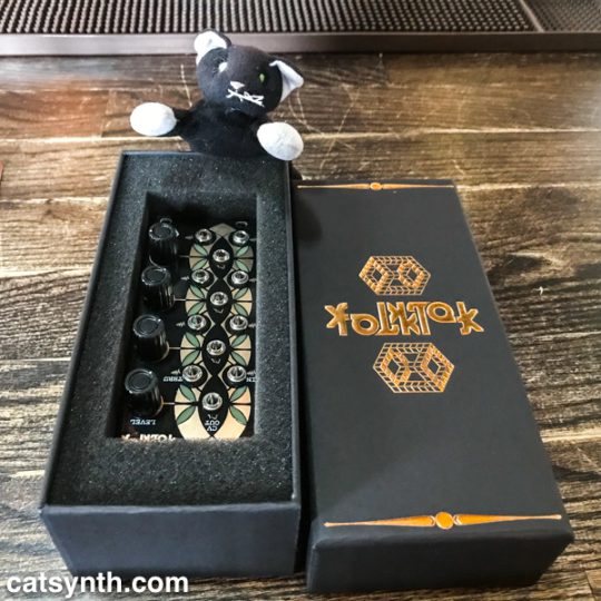
Among the many keyboard and modular displays was this rack featuring modules from FolkTek, one of several local makers in the Portland area. They do have a gorgeous design.
I chatted with the staff and shot some video for an upcoming CatSynth TV, but also walked away with one of the FolkTek modules, a quad envelope follower that I know will come in handy for some upcoming music projects.
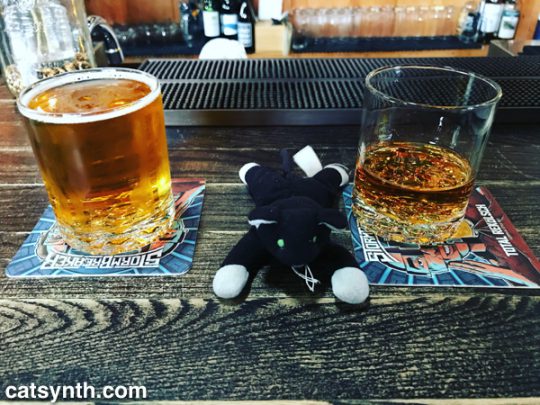
I wandered a few blocks south on Mississippi to StormBreaker Brewing, which I had remembered from a previous trip. In addition to their beer offerings, they had several suggested beer-and-whiskey pairings, which I of course had to try.
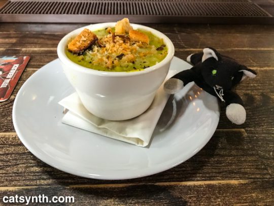
One of the daily specials, a cream-of-asparagus soup, was perfect for that cold and rainy afternoon.
Although this trip took me to quite a few corners of the city, I still felt there was much undone, especially meeting more of the local synth community, and spending some time outdoors. So I do expect to be back much sooner than last time.
See more of Portland, Oregon and many other fascinating places in our Highway☆ app, available on the Apple App Store and Google Play Store.
Facebook has been in the news quite a lot of late. None of it for good reasons. But buried amidst the articles on data privacy and the Cambridge Analytica scandal I found the story “Welcome to Zucktown. Where Everything Is Just Zucky.” in The New York Times. Basically, it discusses Facebook’s plans for a new community adjacent to its Menlo Park campus, with housing, shops, and such.
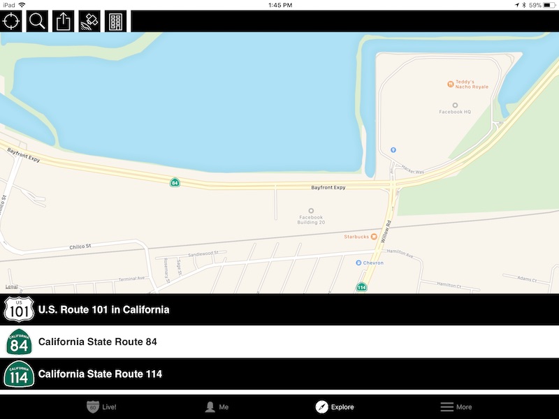
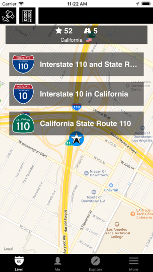
As seen in the above screenshot from our Highway☆ app, Facebook’s campus is at the remote northern edge of Menlo Park, straddling the Bayfront Expressway (California Highway 84). Even by the standards of sprawling Silicon Valley campuses, this one is isolated, with access primarily by car or company busses. The proposed development, which is formally called “Willow Village” (Facebook dislikes the nickname “Zucktown”) would be to its east, between CA 84, Willow Road (unsigned CA 114) and University Avenue (unsigned CA 109), and adjacent to the neighboring town of East Palo Alto. While ostensibly an open community with public access and some affordable housing units, it is clearly being designed for Facebook employees. And although the benefits of living close to work – and cutting down on commutes – are abundant, there is a difference between living near work and living in work. And that is why it touched a raw nerve with me. One of my main critiques working the industry, besides the subtle but rampant sexism, is what I call forced togetherness. In the culture of many tech companies, it isn’t enough to do good work every day or even work long hours. There is tremendous pressure, implicit or explicit, to be socially present at all times, to treat the company as one’s community, one’s “life”.
Forced togetherness comes in much smaller ways than planned communities of coworkers. At a previous job of mine in 2014 at a tiny startup, everyone ate lunch together almost every day. Ostensibly, it was supposed to be Monday, Wednesday, Friday, but it quickly became clear that Tuesday and Thursday were expected as well. One day early when I politely passed on lunch – and was looking forward to going out by myself for a little bit – the CEO seemed perplexed and kept trying to offer one option after another for ordering lunch in. I had to finally just say “Look, I’m a big girl, I can feed myself!” This was met with some quiet and awkward laughter. It’s not that lunch was mandatory, but there was a social expectation, and implicit coercion, that eating together was the right thing to do.
I have come to look for red flags in this regard. In my current job search, another very small company reached out to me with an interesting opportunity. But they were located in Redwood City. I have more than once stated I would sooner move back to New York than take another job on the peninsula – but I played along and politely explained that I prefer to work in San Francisco proper, but did they have flexible or remote work options. I got the following reply.
We do not do remote. It hinders the culture of the company we are building and we love hanging out with each other.
There are many good reasons that some companies require employees to be on site. But what this message told me was that the policy was based not on a business or practical necessity, but on a virtue, a belief that this is how people should be. It says they are more interested in a culture based on “hanging out with each other” than on “getting things done.” It says that to succeed in that culture, one must be someone that they like to hang out with. And this suggests how cultures of forced togetherness go beyond just wiping out the boundaries between work and the rest of one’s life, but also how the monoculture of Silicon Valley is perpetuated. If one is looking for “people we love to hang out with”, one is probably going to hire people that share a similar set of backgrounds, styles, and personalities. Hence, we find bands of mostly young men of white, Indian, and East Asian backgrounds who perpetuate college dorm life into their post-collegiate adulthood.
Of course, these are just simply two anecdotes, along with the concept writ large in Facebook’s Willow Village. I hope to dive deeper in these phenomena in future articles for the “Forced Togetherness Fridays” series, along with some positive stories of how things can go right instead of wrong with only a few cultural changes. And I welcome thoughts from others as I move forward, either sharing your own stories of forced togetherness in the workplace, or even counter-arguments in its favor. Until then, I plan to enjoy some quiet time working hard, by myself with just my cat for company.
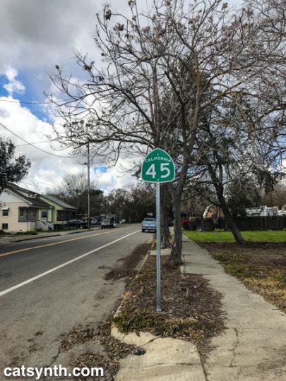
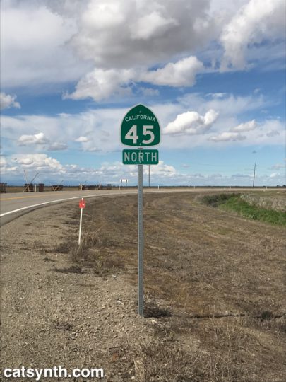
A few years ago, I traveled California’s Highway 41 on my 41st birthday. I had hoped to make this a regular tradition, but various circumstances have kept me from following through, until this year, when I drove the southern half of CaliforniaHighway 45. It wasn’t exactly on my birthday, and I didn’t complete the route, but was still a fun and eccentric way to celebrate the conclusion of my 45th year of life. It was also a good excuse to try out the new travel-mapping feature in our Highway☆ mobile app.
Highway 45 begins in the small town of Knight’s Landing in Yolo County, so I first had to schlep up there via Interstate 80 and then turn north on Highway 113 near U.C. Davis. 113 is a major freeway at this point, but a bit further north it narrows to a two-lane country road before reaching the junction with 45.
Knight’s Landing was actually a very small but cute town along the Sacramento River. Before embarking on the formal part of the trip, I stopped along the levee at Front Street to view the continuation of Highway 113 across the river. Front Street was rather beaten up compared to the rest of the town center, perhaps due to the nature of the levee or to discourage unnecessary driving, but it made for a nice little walk.
I then returned to the car and finally turned onto Highway 45, heading northwest out of town.
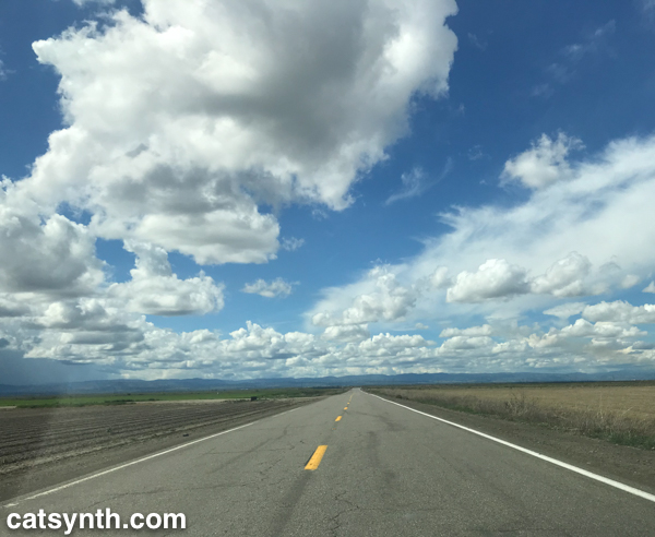
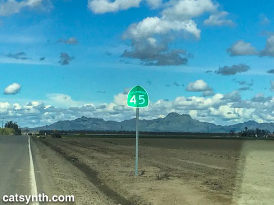
The highway zig-zagged on a grid between fields on the western side of the Sacramento River, but far enough for the river to mostly remain out of sight. But there were some lovely wide-open farmland vistas, made more dramatic by the bands of clouds in the sky marking what was a lovely day after a week of dreary weather.
It is when the landscape opened up that I was able to fully relax into the trip. There is always a point along the journey during which stresses, mundane or otherwise, start to melt away and the road, landscape, and solitude take over the mind. As Highway 45 is remarkably well signed, there was no ambiguity or uncertainty. The result is a sense of flow and well being that allows one to both think about other ideas, like music, while remaining fully engaged in the moment. It is something I have experienced many walking the streets of San Francisco, but not lately. I certainly hope it isn’t gone – as much as I enjoy these long excursions to other regions, I would love to return to the sense of external flow in my own community as well. Perhaps it is the familiarity or the many stresses and dramas, but I hope to regain it.
The highway turned due north in Colusa County, providing great views of the Sutter Buttes, considered to be one of the worlds smallest mountain rangers.
The Buttes are a small circle of volcanic lava domes that rise suddenly from the rather flat Sacramento Valley. The contrast is fascinating, and I would love to come back and explore the geology at a warmer time of year. Unfortunately, public access to the Buttes remains limited as far I can tell. (If any readers have any advice or new information about public access to the Sutter Buttes, please share in the comments.)
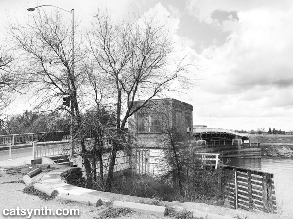
At this point, Highway 45 comes closer to the river, and between Grand Island and Grimes, comes right up against levees, before turning north again. It is not surprising to see such high levees, as the entire region seems like a giant flood waiting to happen.
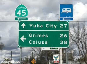
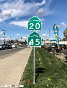
Further north, we join with California Highway 20, a major east-west highway in this rural part of the state connecting to Yuba City to the east and to Lake County far to the west. The road became wider, smoother, and significantly busier as we continued on the duplex into the town of Colusa.
Colusa is a picturesque town on the river, with a small but nice town center and a quiet park along the levee and riverbank. It had warmed up considerably since I last got out in Knight’s Landing, so stopped for a bit to enjoy the sight and sound of the river. You can see a bit in this Instagram video.
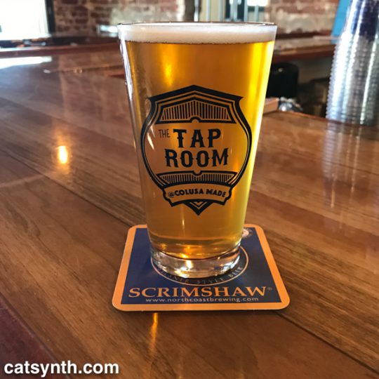
Nearby I found The Tap Room, a small pub that had a large selection of beers including some local brews. I don’t think they had Sutter Butte Brewing, but they did have some selections from Berryessa brewing including this IPA.
In the enjoyment of the trip, I had completely forgotten that it was St. Patrick’s Day. But I was quickly reminded by the bartender who was decked in bright green regalia and informed me of the holiday pub crawl that would be happening that evening. This was the talk of the local patrons who started trickling in as the afternoon wore on. Everyone was friendly and welcoming, but a night of drinking was not going to be compatible with my plan to get back to the city safely at a reasonable hour. So I bid farewell and headed out on Highway 20 back to I-5 and I-505 to return to the Bay Area.
Tired but accomplished, I crossed the Bay Bridge back into San Francisco and home later that evening. That would usually be the end of the story, but after resting, we made the last-minute decision to go out again that night. So I found myself getting dressed up and heading back over the bridge for the third time to Oakland to see Chrome withHelios Creed. We met up with quite a few friends at the show and had a great time. You can see a bit of Chrome’s performance in this CatSynth TV.
It was a great day of diverse geography and experiences, albeit a long one. Not every day can or should be like this, but hope there are more to come this year…
See more Northern California in our Highway☆ app, available on the Apple App Store and Google Play Store.
At least since 2010, all of my trips to NAMM have been road trips, heading east from San Francisco on I-580 to meet Interstate 5 for the long trek south through Los Angeles to Orange County.
I-5 takes a more direct route through the sparsely populated western side of the Central Valley, compared to CA 99 (former US 99) that connects the major towns and cities of the region, including Fresno and Bakersfield. The small communities that one does pass are related to travel on the interstate itself or to the farms and orchards that dominate the landscape between stretches of emptier space.
It is a long trip, and one that I know many people would find boring. But for me, it is something I look forward to, an integral part of the experience along with the show itself, the after-parties and all the other little adventures. This year there was the added fun of testing out Highway☆ on the road trip, but even without that heightened sense of purpose, it is simply an enjoyable “flow experience.” Once over the Altamont Pass and into the Central Valley, stresses begin to fade as the mostly straight line of the road and the low stimulation of I-5 takes over. It may seem “empty” but there is still is just enough detail along the route to provide balance. After many years, I have come to know just about every major junction and many of the other details, such as the names of the small communities along the highway. By the time I arrive in the Los Angeles basin, I am recharged, enough to even remain unfazed by the notorious traffic!
The return trip along a nearly identical route is similarly an opportunity for psychic calm and flow after the nonstop overstimulation of NAMM (I do spend a half day after the show either with friends or at a museum as part of the decompression process before getting back on “The 5”). This year was no different, as I headed back with a tailwind and sense of optimism. Life seemed calm, free, but also filled with curiosity and excitement about professional opportunities in technology, music, and even travel. That feeling lasted into our arrival back in San Francisco, at least until my second bout of this year’s awful flu kicked in, along with some other stressful local responsibilities. One of the mental exercises to help through the ensuing week was to focus on how my mind and body responded positively to the I-5 trip (and to the many tendrils of travel in and around L.A.) and thought experiments on how to capture that sense of enjoyment and calm even when not traveling down a straight and empty stretch of road. I come back again to flow experience and how much that seems to be a product of solitude for me, but it can also come in playing together with musicians at the highest levels. And then there are situations where flow is stymied or non-existent. It is important to recognize both, and I hope to explore these topics more in upcoming articles.
See more of Interstate 5 in California and many other fine places across North America in our Highway☆ app, available on the Apple App Store and Google Play Store.
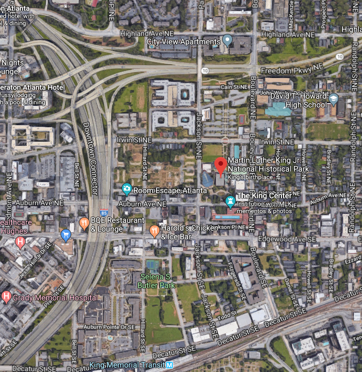
It remains to be seen whether this Martin Luther King Day is more surreal than last the one last year. But in the meantime, we take a virtual trip to downtown Atlanta in the vicinity of the historic and social institutions celebrating Dr. King’s legacy.
The Downtown Connector carries Interstates 75 and 85 through the heart of the city, with downtown Atlanta to the immediate west. Aesthetically, we at CatSynth have a fondness for urban freeways, but we cannot ignore how the adversely affect neighborhoods and displace residents. The Downtown Connector cut the Sweet Auburn neighborhood into two. The historic neighborhood is also bounded by the Freedom Parkway (Georgia State Route 10) to the north, and Blue Line of MARTA to the south, which serves the district via delightfully modernist King Memorial station.
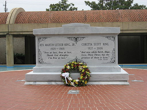
Sweet Auburn is Dr. King’s neighborhood. His childhood home is at 501 Auburn Ave. The Ebeneezer Baptist Church is about a block or so away. The Martin Luther King Jr. National Historic Park covers these and the space in between. On the south side of Auburn Avenue is the King Center (formally, the King Center for Nonviolent Social Change). Martin Luther King Jr’s tomb is on the site. But it is also worth noting that the King Center is not simply a museum, with ongoing research, education programs, and activism.
Many of us are perhaps approaching this day with bated breath, hoping a certain openly racist leader with a tendency to make everything about himself doesn’t make things even worse than they already are. But it might be better to reflect on some of King’s darker words that seem prescient in the moment, such as the Mountaintop Speech or “It’s A Dark Day In Our Nation” (primarily about the Vietnam War). We leave this as an exercise to the reader.
See more of Atlanta and many other fine places across North America in our Highway☆ app, available on the Apple App Store and Google Play Store.
We are excited to announce the release of Highway☆ 1.2.0 for iPhone and iPad! It is available in the Apple App Store.
This new version includes some of our most requested features.
Switch between map and satellite views. This saves battery and bandwidth on the road.
Sometimes connectivity on the road can be poor or non-existent. Highway☆ now matches missed routes once connectivity is restored.
There many more features we have in store, but for the moment we turn our focus to the 1.2 version for Android. And we are looking forward to putting the app through its paces on our upcoming road trip to NAMM 😺


 We at CatSynth love traveling and exploring our adopted home state. This includes day trips from the Bay Area as well as longer adventures. But one thing remains a bit of a challenge. For much of the state, the main highways are primarily north-south, with very few east-west routes. One chooses one of the long-haul north-south highways, California 1, US 101, I-5, California 99, or US 395 and is pretty much locked in with only a few options for efficiently traveling east to west. There is I-80 in the middle north, California 152 or California 46 from the coast through the Central Valley and California 58/I-40/I-15 further south.
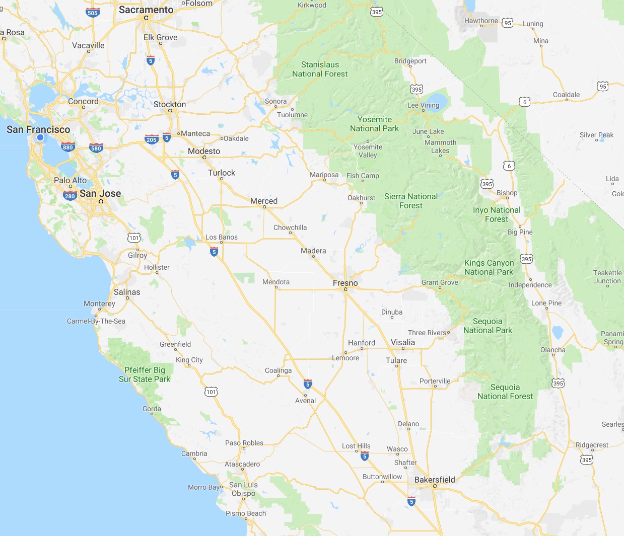


.png)


 The southeast “bulge” part of the district includes sections of Houston that lie within the I-610 loop, or “Inner Loop”. I-610 separates the downtown sections of Houston from outer neighborhoods and surrounding communities, including towns like Southside Place. It is bisected west-to-east by the new I-69 (US 59). The area where these two highways intersect would not look out of place in Los Angeles.

 Heading north and west, we come to the middle section of the district, which is largely a horizontal rectangle bounded by the mighty I-10 to the north, and which extends almost to Katy in the west. Beltway 8, also known as the Sam Houston Parkway/Tollway, bisects this segment of the district. Just to the west of the beltway are the Briarforest neighborhood and the ominously named Energy Corridor. Not surprisingly, several major energy corporations have operations in this area, as do several other businesses. The Buffalo Bayou – we at CatSynth are still not entirely sure what separates a bayou from a river – cuts through the district. It was subject to major flooding during Hurricane Harvey. In addition to the bayou itself cresting at record levels above flood stage. releases from the Barker Reservoir caused severe flooding in adjacent low-lying neighborhoods. We have sources that have informed us that the floodwaters in the Energy Corridor area were most unpleasant.

 The final section of the district cuts an inverted “L” between State Highway 6 and State Highway 99, the outermost loop around Houston, bounded on top by US 290. In all, the district has an odd shape indeed, but not so odd when one considers the tradition of gerrymandering, an art which has been taken to new heights by Texas’ Republican-controlled state government. Its shape has long preserved it as a safe Republican district – it has elected Republicans to Congress consistently since George H.W. Bush in 1966. But the city and surrounding area have been changing, and it is seen as vulnerable to flip to 2018.


 Having enjoyed a full glass of both the Trilogy and Holy Smoke along with tastings of the standards, I decided I shouldn’t do anymore tasting for a while. But I still wanted to some more exploring. So instead of heading straight back south, I turned east onto Highway 128 in Rutherford towards Lake Berryessa, with the goal of finally completing the route. (Yes, I am weird that way.)
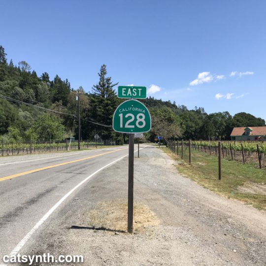
 The next stop took me eastward from downtown to the ragged edges of the city along SE 82nd Avenue (State Route 213). I was here to pick up a borrowed Nord for the show. A mixture of auto-shops, low-rise apartments, and shopping centers made this area feel more like Los Angeles (except for the weather) or the far eastern sections of Queens. But it was still fascinating in its way, and there was an interesting row of shops, bars, and eateries along Stark Street – I wish I had a chance to stop at The Country Cat, but time did not permit this.
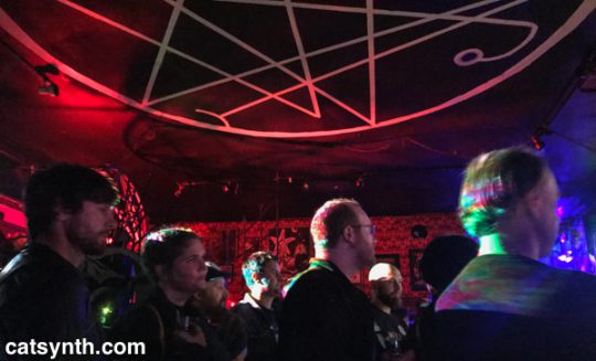

 The next morning I found myself in the Hollywood neighborhood. It was actually the first time on this particular trip that I found myself north of Burnside in the northeast sector of the city. Sandy Boulevard was lined with a diverse collection of low-rise businesses. I crossed I-84/US 30 into the adjacent Grant Park district, which reminded me again of residential neighborhoods with larger lots at the edges of New York City into Westchester and Long Island. I had some personal appointments that morning but then remained in Northeast to visit


 As seen in the above screenshot from our
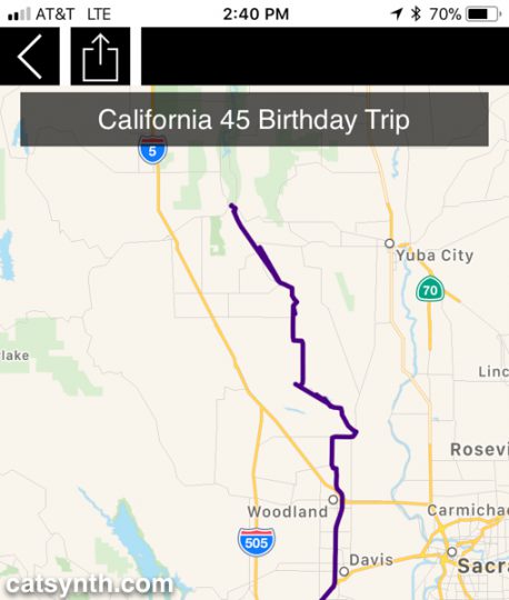
 I-5 takes a more direct route through the sparsely populated western side of the Central Valley, compared to CA 99 (former US 99) that connects the major towns and cities of the region, including Fresno and Bakersfield. The small communities that one does pass are related to travel on the interstate itself or to the farms and orchards that dominate the landscape between stretches of emptier space.
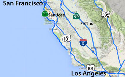


 The Downtown Connector carries Interstates 75 and 85 through the heart of the city, with downtown Atlanta to the immediate west. Aesthetically, we at CatSynth have a fondness for urban freeways, but we cannot ignore how the adversely affect neighborhoods and displace residents. The Downtown Connector cut the Sweet Auburn neighborhood into two. The historic neighborhood is also bounded by the Freedom Parkway (Georgia State Route 10) to the north, and Blue Line of MARTA to the south, which serves the district via delightfully modernist King Memorial station.
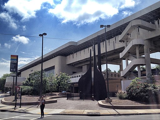