Fun with Highways: Philadelphia

Philadelphia has played an important role for us at CatSynth this year, musically, personally, and now politically. All eyes have been on this city the last few days, and this morning they delivered the crucial votes to call the presidential election.

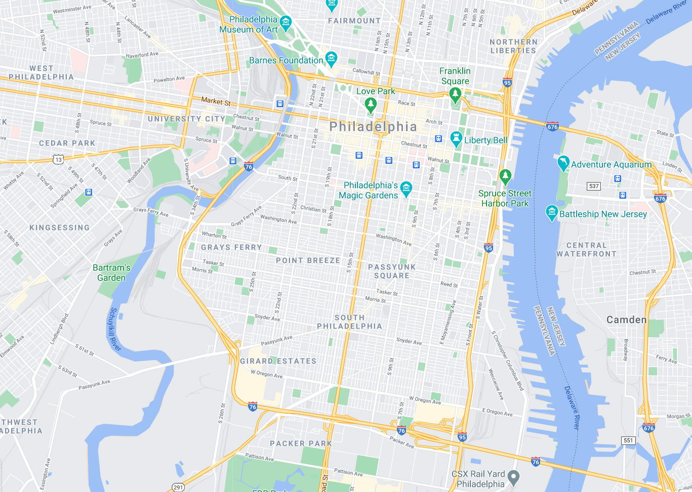
Downtown Philadelphia lies between two rivers, the larger Delaware and the smaller Schuykill. It is further boxed in by three major freeways, I-95, I-76, and I-676 / US 30. Just south if I-676 (which enters the city from the east on the Benjamin Franklin Bridge from New Jersey) are the famous historic sites including Independence Hall, where both the Declaration of Independence and the U.S. Constitution where written.

Independence Hall Clocktower in Philadelphia.jpg
https://commons.wikimedia.org/wiki/File:Independence_Hall_Clocktower_in_Philadelphia.jpg

But modern city is much more than these historic sites, revered as they are. It is one of the largest cities in the country and has its own unique culture. Great seafood, Italian food, and of course cheesesteaks. Also some important centers for modern art and architecture. There is the neo-classical Philadelphia Museum of Art (made famous by Rocky) but also the modernist Institute of Contemporary Art and the University of Pennsylvania.

Institute of Contemporary Art — Visit Philadelphia
https://www.visitphilly.com/things-to-do/attractions/institute-of-contemporary-art/

In addition to the facade of the museum, I like the modernist buildings nearby which are presumably part of the university. (Hey, didn’t someone supposedly graduate from Penn/ Wharton?).

And nestled among the tall buildings of downtown Philly is the Love sculpture by Robert Indiana. Originally part of the 1976 bicentennial celebrations in “the city of brotherly love”, it is now a permanent fixture in the city.

File:Philadelphia, The City of the Brotherly Love - USA - panoramio.jpg -  Wikimedia Commons
700https://commons.wikimedia.org/wiki/File:Philadelphia,The_City_of_the_Brotherly_LoveUSA-_panoramio.jpg

Philadelphia is one of the larger and denser cities in the country, more akin to New York than to Los Angeles.

https://commons.wikimedia.org/wiki/File:Philadelphia_from_South_Street_Bridge_July_2016_panorama_3b.jpg

One of the more famous skyscrapers is the PSFS building. Now a hotel, it was once a the headquarters of the Philadelphia Savings Fund Society. It is an official landmark.

https://commons.wikimedia.org/wiki/File:PSFSBuilding1985.jpg

Of course, we would be remiss if we did not talk about the city’s music. In particular, I have a soft spot for Philly soul of the 1970s, as exemplified by the band MSFB.

They were the house band of Philadelphia Sigma Sound Studios, the seminal house for the city’s particular sound, heavy on strings and detailed production. In addition to MSFB, they spawned many important acts like the O’Jays, the Spinners, the Delfonics and Stylistics, many of whom worked with the great producer Philadelphia producer Thom Bell. The sound and musicians of the city also attracted so called “blue-eyed soul”, such as David Bowie’s Young Americans album, and Elton John’s hit Philadelphia Freedom which was recorded with MFSB. The latter truly seems like song for this moment of celebration.

Many great jazz and funk musicians also came out of Philadelphia and call the city their home. Among them is the drummer G Calvin Weston who worked with Ornette Coleman’s Prime Time, James Blood Ulmer, the Lounge Lizards and more. And he is working with me on my latest musical project as well. You can hear about his history and many other musicians from Philadelphia in our extended interview with him from this summer.

He has been adding the “icing on the cake” to several tracks on my new album scheduled to release in early January, hopefully in time for change of power in our country. But for the moment, I would just like to say how proud I am of the city of Philadelphia and to call them my friends.

Fun with Highways: Christopher Street, New York

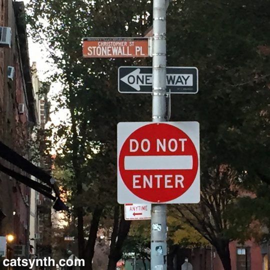
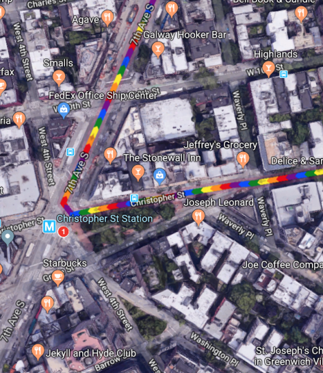
The West Village is an odd place. Streets cross one another at odd angles, leading to situations where numbered streets intersect, and small triangular slivers of park space emerge. One such location is the park where Christopher Street, Grove Street, West 4th, and 7th Avenue all meet.

It’s a sliver of a park, but it includes the Christopher Street subway stop for the 1 IRT, a stop I have found most useful in recent years. And this angular collision of roads also has another significance.

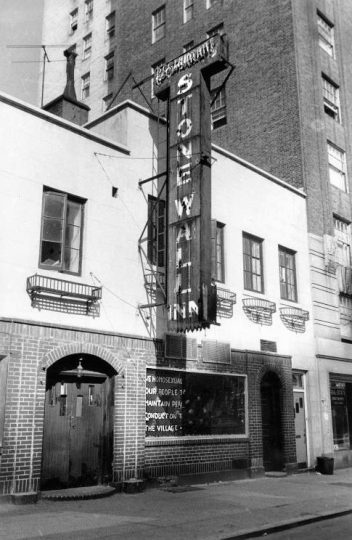
On the northern side of Christopher Street is the Stonewall Inn. The riots 50 years ago turned from a notorious Mafia-run bar for the most outcast members of the queer community to perhaps the sacred site in the world for the LGBTQ community and members of sexual minorities.


Stonewall Inn
, site of the 1969 Stonewall riots, New York City, USA On the Window: „We homosexuals plead with our people to please help maintain peaceful and quiet conduct on the streets of the Village—Mattachine“ (Source: David Carter: Stonewall: The Riots that Sparked the Gay Revolution, St. Martin’s Press, 2004, ISBN 0-312-34269-1, S. 143)

As people converge on lower Manhattan for New York Pride and World Pride – and we gather ourselves here in San Francisco, it’s worth looking back at what happened 50 years ago.

The age of the clientele ranged between the upper teens and early thirties, and the racial mix was evenly distributed among white, black, and Hispanic patrons.[57][59] Because of its even mix of people, its location, and the attraction of dancing, the Stonewall Inn was known by many as “the gay bar in the city”.[60] Police raids on gay bars were frequent—occurring on average once a month for each bar. Many bars kept extra liquor in a secret panel behind the bar, or in a car down the block, to facilitate resuming business as quickly as possible if alcohol was seized.[8][10] Bar management usually knew about raids beforehand due to police tip-offs, and raids occurred early enough in the evening that business could commence after the police had finished.[61] During a typical raid, the lights were turned on, and customers were lined up and their identification cards checked. Those without identification or dressed in full drag were arrested; others were allowed to leave. Some of the men, including those in drag, used their draft cards as identification. Women were required to wear three pieces of feminine clothing, and would be arrested if found not wearing them. Employees and management of the bars were also typically arrested.[61] The period immediately before June 28, 1969, was marked by frequent raids of local bars—including a raid at the Stonewall Inn on the Tuesday before the riots[62]—and the closing of the Checkerboard, the Tele-Star, and two other clubs in Greenwich Village.[63][64]

https://en.wikipedia.org/wiki/Stonewall_riots#Stonewall_Inn

What is notable is what the offenses were. The issues were not so much sexual practices as traditional gender norms. Women without at least three pieces of feminine clothing, men in drag were the targets. And khas vishalom they might even be dancing! It was all about control and conformity. I look back at it with a mixture of bewilderment, pity, disgust, and even contempt for people who were frightened and upset by these behaviors that they would criminalize it violently. And lest we get too smug, violence continues to this date in the United States, most notably the murders transgender women of color. And the attack on conformity is something to be celebrated rather than resisted – indeed that was part of what attracted to this world decades before I knew that I myself was a member of its motley lot.

Many are using the occasion of the 50th anniversary to remind everyone that Stonewall was a riot, a moment of fighting back, rather than simply a large parade. But the parades and celebrations are great, too, as a reminder of what has changed. Indeed, one of the most criticized elements of Pride in this decade of the 21st century is just how commercial and “corporate” it has become. Sure, it’s tacky at times and easy to be cynical about some corporations’ motives. But the point is that mainstream businesses want to be seen as being on the side of the LGBTQ community, the “right” side, and the “profitable” side. One day it will be those who were so frightened by and bothered by these expressions of love and individual identity that they must respond with violence and law who will be pushed to the margins. And push them we shall, but it a way that still preserves their dignity and individuality, lest we end up making similar mistakes.

Fun with Highways: California 99 and 198

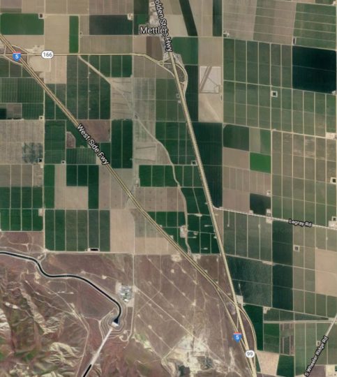
The ride back from NAMM is usually an uneventful straight shot up I-5 from Los Angeles towards San Francisco. But I found myself making good time, and in a mood for a bit of exploration – not to mention an opportunity to rack up more routes on my Highway☆ app – so I decided to try something different. I decided to follow California Highway 99 as it splits off from I-5.

CA 99 takes a more easterly route than I-5 and connects to the major towns and cities of the Central Valley. A stretch in the northern part of the Central Valley was featured in our recent CatSynth TV Episode 99, but the southern part largely remained unexplored outside the immediate vicinity of Bakersfield (where it intersects CA 58). So much of the highway was new.

That southernmost section was, to put it bluntly, rather sad. The road is narrow, bumpy, and crowded. The landscape was dotted with a mixture of fields, run-down housing developments, and strip malls. And the sky was smoggy with an unhealthy yellow hue. But the afterglow of our most successful NAMM show to date along with the spirit of exploration gave a level of joy to the experience. At Visalia, I decided to turn off and head west onto California Highway 198.

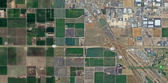
If 99 was a bit of a cluttered and bumpy mess, 198 was the opposite: a pair of smooth straight lines cutting through farmland with sparse development. It began as an expressway but soon turned into a full-on freeway in Kings County as we headed toward Hanford and then on to Lemoore, where we intersected with Highway 41 in a major interchange. A few years ago, I had seen it from the perspective of Highway 41 and mentioned it a post at that time.

There is something strangely fascinating about the island of small towns sitting at the northern edge of dry endorheic Lake Tulare. I can’t quite put my finger on it, but it is strong enough to inspire a story line and possible writing project that I work through in my mind when I have trouble sleeping at night. We will see if anything comes of it.

Past Lemoore Naval Air Station, 198 narrows to a small two-lane route, and becomes significantly less interesting. My mind shifts to the story on the radio about people whose altruism goes to extreme lengths, including a man in India who founded and nurtured a growing community for people with leprosy while putting himself and his family (including two young children) at risk; and a couple who kept adopting more and more children while having less time and attention for their older biological and adopted children. These drives can be seen as incredibly caring and generous, but I also wondered if they were a bit pathological – indeed, the seeming lack of concern for others affected as they pursued their extreme altruism seemed to be mark of a sociopath.

Heading west on the narrow section of CA 198, we approach Interstate 5 again. This is, however, a spot infamous to north-south travelers for its offending aroma. It turns out the infamous small at the Coalinga junction of I-5 and CA 198 comes from the gigantic Harris ranch and feedlot. It only got worse after turning north onto I-5, but soon enough it was behind me and a not-too-long road to San Francisco remained ahead.

See more of California and many other fascinating places in our Highway☆ app, available on the Apple App Store and Google Play Store.

Highway☆ on the Apple App Store
Highway☆ for Android

CatSynth TV Episode 99!

It’s the 99th Episode of CatSynth TV, and we have a special treat for all our readers and videos. It combines many of our interests: synthesizers, cats, experimental music and film, and highways.

Video shot along Highway 99 in California from Manteca through Stockton and heading towards Sacramento. Additional video and photography at CatSynth HQ in San Francisco.

Guest appearances by Sam Sam and Big Merp.

Original experimental synthesizer music by Amanda Chaudhary, based on melodies from “99 is not 100” by Moe! Staiano.

Synthesizers used:

  • Minimoog
  • Arturia MiniBrute 2S
  • Big Fish Audio John Cage Prepared Piano Sample Library (Kontakt)
  • Nord Stage EX
  • Mutable Instruments Plaits
  • Metasonix R-54 and R-53 2hp Cat module
  • 4ms Spectral Multiband Resonator
  • Make Noise Echophon

Pick Your Poison: Road Travel in California

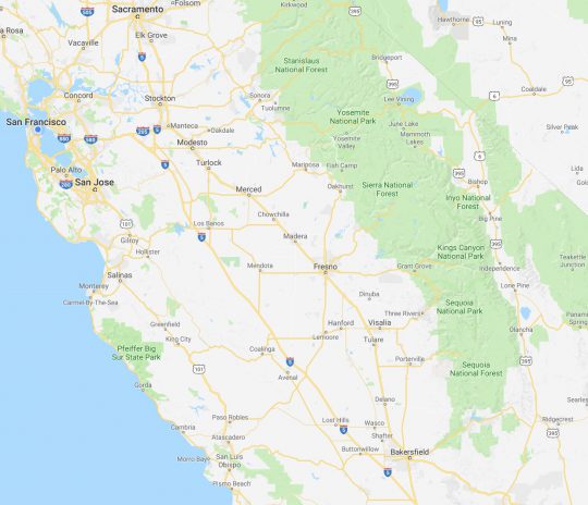
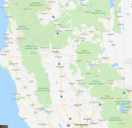
We at CatSynth love traveling and exploring our adopted home state.  This includes day trips from the Bay Area as well as longer adventures.  But one thing remains a bit of a challenge.  For much of the state, the main highways are primarily north-south, with very few east-west routes.  One chooses one of the long-haul north-south highways, California 1, US 101, I-5, California 99, or US 395 and is pretty much locked in with only a few options for efficiently traveling east to west.  There is I-80 in the middle north, California 152 or California 46 from the coast through the Central Valley and California 58/I-40/I-15 further south.


North of Sacramento, east-west travel becomes even more difficult, with routes like California 20 and California 299 being relatively rural and windy for much of their length.  The end result is that most of our trips – especially single-day trips heading north – are forward and back along one of the main north-south routes unless we have extra time or necessity to use the smaller east-west roads.

This north-south bias can be seen in an almost self-similar way when zooming in on the extended Bay Area.  South of San Francisco, there is California 1, I-280, US 101, I-880, I-680 and then not much at all until one gets to I-5 in the Central Valley.

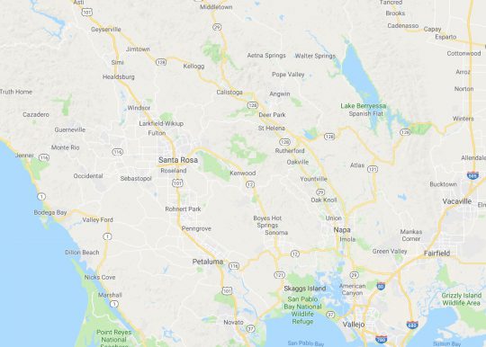
In the North Bay and wine country, a similar pattern appears with CA 1, US 101 and CA 29, with another large gap until I-505 and I-5.  We have made use of east-west roads like CA 128 to get between them as in our recent wine-country trip that featured Elsie the Library Cat.  But this is a long detour.

This north-south axis may be frustrating at times (especially the further north one gets), but there is nothing particularly sinister about it.  It’s all a matter of Calfornia’s geology.  The interface of the Pacific and North American plates that give us our reputation for earthquakes also lead to long bands of north-south mountain ranges and valleys.  The Sierra Nevada may be the most dramatic, but it is only one of several that form vertical stripes, with the Central, Sacramento, Salinas, and Napa valleys in between.  The San Francisco Bay can be seen as another such valley in a way, with shallows bounded by high hills running north-south.

The exception to the “north-south rule” can be found south of the San Gabrial mountains and into the desert.  From Los Angeles and San Diego, one can easily travel east-west to the desert towns and to the Arizona border on I-10 and I-8, with a network of other east-west freeways in between.  It is definitely a different experience traveling down there once one gets over the Grapevine or the Tehachapi Pass and into the southern realms.  As for the rest of the state, there is no escaping the geographic reality, so it is best to embrace it, and even enjoy it.

Fun with Highways: 45 on California 45

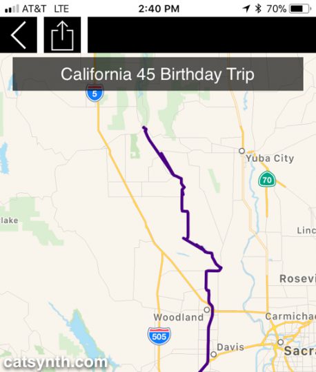
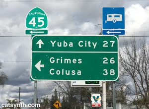
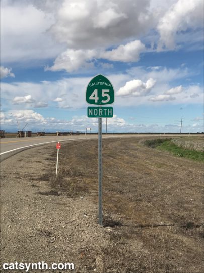
A few years ago, I traveled California’s Highway 41 on my 41st birthday. I had hoped to make this a regular tradition, but various circumstances have kept me from following through, until this year, when I drove the southern half of California Highway 45.  It wasn’t exactly on my birthday, and I didn’t complete the route, but was still a fun and eccentric way to celebrate the conclusion of my 45th year of life.  It was also a good excuse to try out the new travel-mapping feature in our Highway☆ mobile app.

Highway 45 begins in the small town of Knight’s Landing in Yolo County, so I first had to schlep up there via Interstate 80 and then turn north on Highway 113 near U.C. Davis.  113 is a major freeway at this point, but a bit further north it narrows to a two-lane country road before reaching the junction with 45.

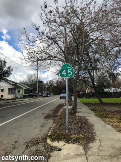
CA 45 in Knight's Landing, CA

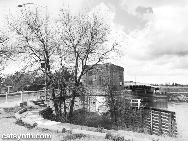
Knight’s Landing was actually a very small but cute town along the Sacramento River. Before embarking on the formal part of the trip, I stopped along the levee at Front Street to view the continuation of Highway 113 across the river.  Front Street was rather beaten up compared to the rest of the town center, perhaps due to the nature of the levee or to discourage unnecessary driving, but it made for a nice little walk.

I then returned to the car and finally turned onto Highway 45, heading northwest out of town.

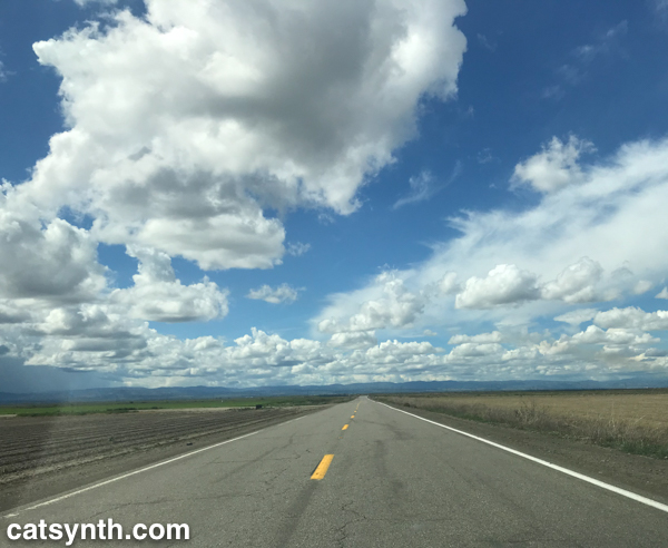
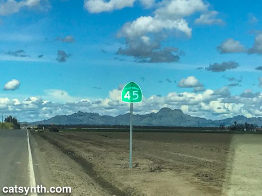
The highway zig-zagged on a grid between fields on the western side of the Sacramento River, but far enough for the river to mostly remain out of sight.  But there were some lovely wide-open farmland vistas, made more dramatic by the bands of clouds in the sky marking what was a lovely day after a week of dreary weather.

It is when the landscape opened up that I was able to fully relax into the trip.  There is always a point along the journey during which stresses, mundane or otherwise, start to melt away and the road, landscape, and solitude take over the mind.  As Highway 45 is remarkably well signed, there was no ambiguity or uncertainty.  The result is a sense of flow and well being that allows one to both think about other ideas, like music, while remaining fully engaged in the moment.  It is something I have experienced many walking the streets of San Francisco, but not lately.  I certainly hope it isn’t gone – as much as I enjoy these long excursions to other regions, I would love to return to the sense of external flow in my own community as well.  Perhaps it is the familiarity or the many stresses and dramas, but I hope to regain it.

The highway turned due north in Colusa County, providing great views of the Sutter Buttes, considered to be one of the worlds smallest mountain rangers.

The Buttes are a small circle of volcanic lava domes that rise suddenly from the rather flat Sacramento Valley.  The contrast is fascinating, and I would love to come back and explore the geology at a warmer time of year.  Unfortunately, public access to the Buttes remains limited as far I can tell. (If any readers have any advice or new information about public access to the Sutter Buttes, please share in the comments.)

At this point, Highway 45 comes closer to the river, and between Grand Island and Grimes, comes right up against levees, before turning north again.  It is not surprising to see such high levees, as the entire region seems like a giant flood waiting to happen.

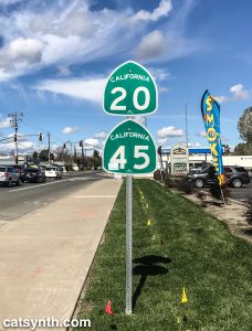
Further north, we join with California Highway 20, a major east-west highway in this rural part of the state connecting to Yuba City to the east and to Lake County far to the west.  The road became wider, smoother, and significantly busier as we continued on the duplex into the town of Colusa.

CA 20 and CA 45 in Colusa, California

Colusa is a picturesque town on the river, with a small but nice town center and a quiet park along the levee and riverbank.  It had warmed up considerably since I last got out in Knight’s Landing, so stopped for a bit to enjoy the sight and sound of the river.  You can see a bit in this Instagram video.

Sacramento River in Colusa, CA

A post shared by CatSynth / Amanda C (@catsynth) on

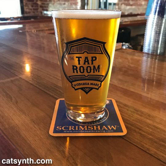
Nearby I found The Tap Room, a small pub that had a large selection of beers including some local brews.  I don’t think they had Sutter Butte Brewing, but they did have some selections from Berryessa brewing including this IPA.

IPA at the Tap Room, Colusa California

In the enjoyment of the trip, I had completely forgotten that it was St. Patrick’s Day.  But I was quickly reminded by the bartender who was decked in bright green regalia and informed me of the holiday pub crawl that would be happening that evening.  This was the talk of the local patrons who started trickling in as the afternoon wore on.  Everyone was friendly and welcoming, but a night of drinking was not going to be compatible with my plan to get back to the city safely at a reasonable hour.  So I bid farewell and headed out on Highway 20 back to I-5 and I-505 to return to the Bay Area.

Tired but accomplished, I crossed the Bay Bridge back into San Francisco and home later that evening.  That would usually be the end of the story, but after resting, we made the last-minute decision to go out again that night.  So I found myself getting dressed up and heading back over the bridge for the third time to Oakland to see Chrome with Helios Creed.  We met up with quite a few friends at the show and had a great time.  You can see a bit of Chrome’s performance in this CatSynth TV.

It was a great day of diverse geography and experiences, albeit a long one.  Not every day can or should be like this, but hope there are more to come this year…

See more Northern California in our Highway☆ app, available on the Apple App Store and Google Play Store. 

Highway☆ on Apple App Store .   Highway☆ for Android

Interstate 5, California: The Road to (and from) NAMM

At least since 2010, all of my trips to NAMM have been road trips, heading east from San Francisco on I-580 to meet Interstate 5 for the long trek south through Los Angeles to Orange County.

CatSynth on Interstate 5

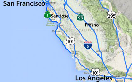
I-5 takes a more direct route through the sparsely populated western side of the Central Valley, compared to CA 99 (former US 99) that connects the major towns and cities of the region, including Fresno and Bakersfield.  The small communities that one does pass are related to travel on the interstate itself or to the farms and orchards that dominate the landscape between stretches of emptier space.
It is a long trip, and one that I know many people would find boring.  But for me, it is something I look forward to, an integral part of the experience along with the show itself, the after-parties and all the other little adventures. This year there was the added fun of testing out Highway☆ on the road trip, but even without that heightened sense of purpose, it is simply an enjoyable “flow experience.”  Once over the Altamont Pass and into the Central Valley, stresses begin to fade as the mostly straight line of the road and the low stimulation of I-5 takes over.  It may seem “empty” but there is still is just enough detail along the route to provide balance.  After many years, I have come to know just about every major junction and many of the other details, such as the names of the small communities along the highway.  By the time I arrive in the Los Angeles basin, I am recharged, enough to even remain unfazed by the notorious traffic!

The return trip along a nearly identical route is similarly an opportunity for psychic calm and flow after the nonstop overstimulation of NAMM (I do spend a half day after the show either with friends or at a museum as part of the decompression process before getting back on “The 5”).  This year was no different, as I headed back with a tailwind and sense of optimism.   Life seemed calm, free, but also filled with curiosity and excitement about professional opportunities in technology, music, and even travel.  That feeling lasted into our arrival back in San Francisco, at least until my second bout of this year’s awful flu kicked in, along with some other stressful local responsibilities.  One of the mental exercises to help through the ensuing week was to focus on how my mind and body responded positively to the I-5 trip (and to the many tendrils of travel in and around L.A.) and thought experiments on how to capture that sense of enjoyment and calm even when not traveling down a straight and empty stretch of road.  I come back again to flow experience and how much that seems to be a product of solitude for me, but it can also come in playing together with musicians at the highest levels.  And then there are situations where flow is stymied or non-existent.  It is important to recognize both, and I hope to explore these topics more in upcoming articles.

See more of Interstate 5 in California and many other fine places across North America in our Highway☆ app, available on the Apple App Store and Google Play Store.

Highway☆ on Apple App Store .   Highway☆ for Android

New CatSynth TV: I-87 Beer

Our latest CatSynth TV is about…beer!

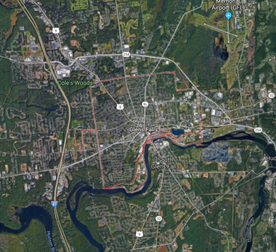
Specifically, I-87, a limited-edition American IPA made by Davidson Brothers Brewing Company in Glenn Falls, New York.  Glenn Falls is a little north of Albany and just south of Lake George.

Glenn Falls New York

NY 32NY 9LAs we can see from this map, it is just east of Interstate 87, here the Adirondack Northway, so the name for the beer is not at all surprising.  US 9 also goes through the town center, as does one of its myriad auxiliary routes, NY 9L, and NY 32 which like US 9 and I-87,  follows the Hudson River.

As for the beer itself, it is definitely an IPA and has the characteristics one would expect, including the hoppy flavor.  But it also had a bit of a sweet/caramel flavor as well.  I’m by no means an official beer expert, but I quite liked it.   I will have to drop by the brewery when I’m that far north in New York state again.

See more of Glenn Falls, New York and many other fine towns across North America in our Highway☆ app, available on the Apple App Store and Google Play Store.

Highway☆ on Apple App Store .   Highway☆ for Android

Fun with Highways: Pittsburgh

With Pittsburgh in the news, perhaps for all the wrong reasons, we thought we would have a little fun exploring what the city has to offer.

The city is located at the convergence of the Allegheny and Monongahela Rivers, which merge to form the mighty Ohio River. This was a fact we learned young with the frequent appearances of Three Rivers Stadium on TV and the subsequent challenges to name the three rivers. For whatever reason, Allegheny was the hardest to remember.

The downtown is wedged between the two upper rivers and enveloped by a network of highways including I-279, I-376, I-579 and PA 28. In this early-morning photo, we are looking across the Monongahela River, with I-376 along the shore and the skyscrapers of downtown behind it. As a city of rivers, it also becomes a city of bridges.


[By Dllu (Own work) [CC BY-SA 4.0], via Wikimedia Commons[]

The Pittsburgh of 2017 (even the Pittsburgh of 1997) is far distant from its industrial past as a center of steel, coal and many other manufactured materials. This history does live on in many circa-1900 houses and buildings, and the ubiquitous presence of Andrew Carnegie. Perhaps the most significant of his legacies to the city is Carnegie Mellon University. It has one of the top Computer Science departments, and one of the first Robotics departments. But the university is also a leader in combining science and art. They recently became the one of the first universities to offer an integrated practice in robots and performing arts; and I have collaborated with professors and students in computer music, including Roger Dannenburg, whose work on managing time in computer-music systems influenced my own research on the topic. CMU is located far to the east of downtown.

Among the sons of Pittsburgh is Andy Warhol, love him or hate him, he was a major influence on American art in the late 20th century. The Andy Warhol Museum sits on the north shore of the Allegheny, not far from I-279 and PA 28.


[By Jared and Corin [CC BY-SA 2.0], via Wikimedia Commons[]

There is even an Andy Warhol Bridge!

Like my home cities of San Francisco and New York, many of the city streets in hilly Pittsburg are actually staircases, which sound like a lot of fun to explore. One can take official walking tours, or simply wander (as I often prefer myself).


[By PJ Rey (Pittsburgh Stairs) [CC BY 2.0], via Wikimedia Commons]

We would be remiss if we did not also give a shout-out to our friends at Pittsburgh Modular Synthesizers. We have several of their modules, which feature a classic mid-century design aesthetic. (They also include space-themed cards and tchotchkes in each box.) You can read our many posts featuring Pittsburgh Modular synths, sometimes with cats.

With these characteristics of a truly modern city, it’s not surprising the the mayor, Bill Peduto pushed back on the use of Pittsburgh as a prop for President’s disastrous decision. As he states in this quote [1]:

“Couldn’t have picked a worst city,” he said flatly. “I was in Paris with 500 mayors around the world. It wasn’t only heavy on fossil fuels but it went through a depression where our unemployment was greater than the Great Depression.’ It was only when we started to look to the future we started to have an economy going up. Today, we’re back on a global stage, not through our old economy, through robotics and artificial intelligence and if it weren’t for that position Pittsburgh would never have been able to get back up.”

We at CatSynth hope to visit the city sometime soon.

See more of Pittsburgh and many other fine cities in our Highway☆ app, available on the Apple App Store.

Highway☆ Released on the App Store!

Highway☆

We at CatSynth are excited to announce the release of our newest app Highway☆ for iPhone and iPad, available on the App Store!

This app comes out of long-term interest in highways and road travel, something we explore periodically on this site. It’s a sort of “Pokemon Go” for travelers and road geeks, where you can discovery and collect highways as you travel.

Highway☆ iPhone screenshot

It also has features for exploring new places on your device, and finding more information about the roads. You can also connect with other users and compete for the top scores.

It is completely free, so please download and have fun, especially if you are planning to hit the road this summer. And please let us know what you think or if you have ideas for new features 😺

And we are currently busy at work on an Android version, which we hope to share soon.